Mont-Saint-Martin | |
|---|---|
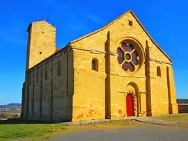 St. Martin's Church | |
.svg.png.webp) Coat of arms | |
Location of Mont-Saint-Martin | |
 Mont-Saint-Martin  Mont-Saint-Martin | |
| Coordinates: 49°32′28″N 5°46′48″E / 49.5411°N 5.78°E | |
| Country | France |
| Region | Grand Est |
| Department | Meurthe-et-Moselle |
| Arrondissement | Briey |
| Canton | Mont-Saint-Martin |
| Intercommunality | Grand Longwy Agglomération |
| Government | |
| • Mayor (2020–2026) | Serge De Carli[1] |
| Area 1 | 8.84 km2 (3.41 sq mi) |
| Population | 9,202 |
| • Density | 1,000/km2 (2,700/sq mi) |
| Time zone | UTC+01:00 (CET) |
| • Summer (DST) | UTC+02:00 (CEST) |
| INSEE/Postal code | 54382 /54350 |
| Elevation | 260–398 m (853–1,306 ft) (avg. 335 m or 1,099 ft) |
| 1 French Land Register data, which excludes lakes, ponds, glaciers > 1 km2 (0.386 sq mi or 247 acres) and river estuaries. | |
Mont-Saint-Martin (French pronunciation: [mɔ̃ sɛ̃ maʁtɛ̃] ⓘ; German: Martinsberg; Luxembourgish: Mäertesbierg) is a commune in the Meurthe-et-Moselle department in north-eastern France. It is part of the urban area of Longwy.[3]
Population
| Year | Pop. | ±% p.a. |
|---|---|---|
| 1968 | 10,035 | — |
| 1975 | 11,556 | +2.04% |
| 1982 | 10,419 | −1.47% |
| 1990 | 8,660 | −2.28% |
| 1999 | 8,241 | −0.55% |
| 2007 | 8,078 | −0.25% |
| 2012 | 7,936 | −0.35% |
| 2017 | 8,807 | +2.10% |
| Source: INSEE[4] | ||
See also
References
- ↑ "Répertoire national des élus: les maires". data.gouv.fr, Plateforme ouverte des données publiques françaises (in French). 2 December 2020.
- ↑ "Populations légales 2021". The National Institute of Statistics and Economic Studies. 28 December 2023.
- ↑ Unité urbaine 2020 de Longwy (partie française) (54405), INSEE
- ↑ Population en historique depuis 1968, INSEE
Wikimedia Commons has media related to Mont-Saint-Martin (Meurthe-et-Moselle).
This article is issued from Wikipedia. The text is licensed under Creative Commons - Attribution - Sharealike. Additional terms may apply for the media files.