Vannes-le-Châtel | |
|---|---|
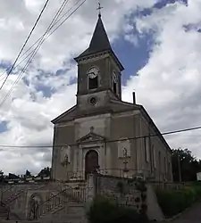 The church in Vannes-le-Châtel | |
 Coat of arms | |
Location of Vannes-le-Châtel | |
 Vannes-le-Châtel  Vannes-le-Châtel | |
| Coordinates: 48°32′48″N 5°46′49″E / 48.5467°N 5.7803°E | |
| Country | France |
| Region | Grand Est |
| Department | Meurthe-et-Moselle |
| Arrondissement | Toul |
| Canton | Meine au Saintois |
| Intercommunality | CC Pays de Colombey et Sud Toulois |
| Government | |
| • Mayor (2020–2026) | Nathalie Aufrere[1] |
| Area 1 | 17.3 km2 (6.7 sq mi) |
| Population | 518 |
| • Density | 30/km2 (78/sq mi) |
| Time zone | UTC+01:00 (CET) |
| • Summer (DST) | UTC+02:00 (CEST) |
| INSEE/Postal code | 54548 /54112 |
| Elevation | 267–432 m (876–1,417 ft) (avg. 290 m or 950 ft) |
| 1 French Land Register data, which excludes lakes, ponds, glaciers > 1 km2 (0.386 sq mi or 247 acres) and river estuaries. | |
Vannes-le-Châtel (French pronunciation: [van lə ʃatɛl]) is a commune in the Meurthe-et-Moselle department in north-eastern France.
Population
| Year | Pop. | ±% p.a. |
|---|---|---|
| 1968 | 582 | — |
| 1975 | 512 | −1.81% |
| 1982 | 563 | +1.37% |
| 1990 | 519 | −1.01% |
| 1999 | 515 | −0.09% |
| 2009 | 570 | +1.02% |
| 2014 | 577 | +0.24% |
| 2020 | 523 | −1.62% |
| Source: INSEE[3] | ||
See also
References
- ↑ "Répertoire national des élus: les maires". data.gouv.fr, Plateforme ouverte des données publiques françaises (in French). 2 December 2020.
- ↑ "Populations légales 2021". The National Institute of Statistics and Economic Studies. 28 December 2023.
- ↑ en historique depuis 1968, INSEE
Wikimedia Commons has media related to Vannes-le-Châtel.
This article is issued from Wikipedia. The text is licensed under Creative Commons - Attribution - Sharealike. Additional terms may apply for the media files.