Ormes-et-Ville | |
|---|---|
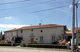 The town hall in Ormes-et-Ville | |
.svg.png.webp) Coat of arms | |
Location of Ormes-et-Ville | |
 Ormes-et-Ville  Ormes-et-Ville | |
| Coordinates: 48°29′19″N 6°12′13″E / 48.4886°N 6.2036°E | |
| Country | France |
| Region | Grand Est |
| Department | Meurthe-et-Moselle |
| Arrondissement | Nancy |
| Canton | Meine au Saintois |
| Intercommunality | CC Pays du Saintois |
| Government | |
| • Mayor (2020–2026) | Gilbert Godfroy[1] |
| Area 1 | 12.49 km2 (4.82 sq mi) |
| Population | 220 |
| • Density | 18/km2 (46/sq mi) |
| Time zone | UTC+01:00 (CET) |
| • Summer (DST) | UTC+02:00 (CEST) |
| INSEE/Postal code | 54411 /54740 |
| Elevation | 234–333 m (768–1,093 ft) (avg. 305 m or 1,001 ft) |
| 1 French Land Register data, which excludes lakes, ponds, glaciers > 1 km2 (0.386 sq mi or 247 acres) and river estuaries. | |
Ormes-et-Ville (French pronunciation: [ɔʁm e vil]) is a commune in the Meurthe-et-Moselle department in north-eastern France.
Geography
The river Madon flows through the commune.
See also
References
- ↑ "Répertoire national des élus: les maires". data.gouv.fr, Plateforme ouverte des données publiques françaises (in French). 2 December 2020.
- ↑ "Populations légales 2021". The National Institute of Statistics and Economic Studies. 28 December 2023.
Wikimedia Commons has media related to Ormes-et-Ville.
This article is issued from Wikipedia. The text is licensed under Creative Commons - Attribution - Sharealike. Additional terms may apply for the media files.