Réchicourt-la-Petite | |
|---|---|
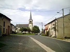 The church in Réchicourt-la-Petite | |
 Coat of arms | |
Location of Réchicourt-la-Petite | |
 Réchicourt-la-Petite  Réchicourt-la-Petite | |
| Coordinates: 48°43′11″N 6°35′01″E / 48.7197°N 6.5836°E | |
| Country | France |
| Region | Grand Est |
| Department | Meurthe-et-Moselle |
| Arrondissement | Lunéville |
| Canton | Baccarat |
| Intercommunality | Pays du Sânon |
| Government | |
| • Mayor (2020–2026) | Philippe Guillaumont[1] |
| Area 1 | 5.5 km2 (2.1 sq mi) |
| Population | 64 |
| • Density | 12/km2 (30/sq mi) |
| Time zone | UTC+01:00 (CET) |
| • Summer (DST) | UTC+02:00 (CEST) |
| INSEE/Postal code | 54446 /54370 |
| Elevation | 228–313 m (748–1,027 ft) (avg. 258 m or 846 ft) |
| 1 French Land Register data, which excludes lakes, ponds, glaciers > 1 km2 (0.386 sq mi or 247 acres) and river estuaries. | |
Réchicourt-la-Petite (French pronunciation: [ʁeʃikuʁ la pətit]) is a commune in the Meurthe-et-Moselle department in north-eastern France.
At a place called "le Haut des Ruelles" died the first 3 Americans on the field of France during World War 1.[3]
See also
References
- ↑ "Répertoire national des élus: les maires". data.gouv.fr, Plateforme ouverte des données publiques françaises (in French). 2 December 2020.
- ↑ "Populations légales 2021". The National Institute of Statistics and Economic Studies. 28 December 2023.
- ↑ "Les trois premiers morts américains de la Première Guerre mondiale". October 2017.
Wikimedia Commons has media related to Réchicourt-la-Petite.
This article is issued from Wikipedia. The text is licensed under Creative Commons - Attribution - Sharealike. Additional terms may apply for the media files.