Tucquegnieux | |
|---|---|
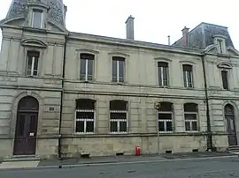 The old town hall in Tucquegnieux | |
.svg.png.webp) Coat of arms | |
Location of Tucquegnieux | |
 Tucquegnieux  Tucquegnieux | |
| Coordinates: 49°18′13″N 5°53′01″E / 49.3036°N 5.8836°E | |
| Country | France |
| Region | Grand Est |
| Department | Meurthe-et-Moselle |
| Arrondissement | Briey |
| Canton | Pays de Briey |
| Intercommunality | CC Cœur du Pays-Haut |
| Government | |
| • Mayor (2020–2026) | Marianne Della-Noce/ Wawrzyniak[1] |
| Area 1 | 9.20 km2 (3.55 sq mi) |
| Population | 2,430 |
| • Density | 260/km2 (680/sq mi) |
| Time zone | UTC+01:00 (CET) |
| • Summer (DST) | UTC+02:00 (CEST) |
| INSEE/Postal code | 54536 /54640 |
| Elevation | 228–310 m (748–1,017 ft) (avg. 240 m or 790 ft) |
| 1 French Land Register data, which excludes lakes, ponds, glaciers > 1 km2 (0.386 sq mi or 247 acres) and river estuaries. | |
Tucquegnieux (French pronunciation: [tykɲø]) is a commune in the Meurthe-et-Moselle department in north-eastern France.
Population
| Year | Pop. | ±% p.a. |
|---|---|---|
| 1968 | 4,842 | — |
| 1975 | 3,911 | −3.00% |
| 1982 | 3,367 | −2.12% |
| 1990 | 3,017 | −1.36% |
| 1999 | 2,726 | −1.12% |
| 2007 | 2,634 | −0.43% |
| 2012 | 2,565 | −0.53% |
| 2017 | 2,469 | −0.76% |
| Source: INSEE[3] | ||
See also
References
- ↑ "Répertoire national des élus: les maires" (in French). data.gouv.fr, Plateforme ouverte des données publiques françaises. 13 September 2022.
- ↑ "Populations légales 2021". The National Institute of Statistics and Economic Studies. 28 December 2023.
- ↑ Population en historique depuis 1968, INSEE
Wikimedia Commons has media related to Tucquegnieux.
This article is issued from Wikipedia. The text is licensed under Creative Commons - Attribution - Sharealike. Additional terms may apply for the media files.