La Chapelle-Urée | |
|---|---|
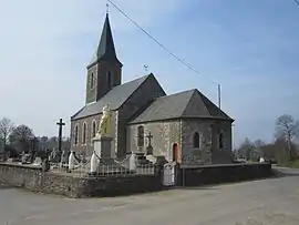 The church of Notre-Dame | |
Location of La Chapelle-Urée | |
 La Chapelle-Urée  La Chapelle-Urée | |
| Coordinates: 48°40′18″N 1°09′00″W / 48.6717°N 1.15°W | |
| Country | France |
| Region | Normandy |
| Department | Manche |
| Arrondissement | Avranches |
| Canton | Isigny-le-Buat |
| Intercommunality | CA Mont-Saint-Michel-Normandie |
| Government | |
| • Mayor (2020–2026) | Jocelyne Leprieur[1] |
| Area 1 | 4.60 km2 (1.78 sq mi) |
| Population | 170 |
| • Density | 37/km2 (96/sq mi) |
| Time zone | UTC+01:00 (CET) |
| • Summer (DST) | UTC+02:00 (CEST) |
| INSEE/Postal code | 50124 /50370 |
| Elevation | 140–237 m (459–778 ft) (avg. 212 m or 696 ft) |
| 1 French Land Register data, which excludes lakes, ponds, glaciers > 1 km2 (0.386 sq mi or 247 acres) and river estuaries. | |
La Chapelle-Urée (French pronunciation: [la ʃapɛl yʁe]) is a commune in the Manche department in Normandy in north-western France.
See also
References
- ↑ "Répertoire national des élus: les maires". data.gouv.fr, Plateforme ouverte des données publiques françaises (in French). 2 December 2020.
- ↑ "Populations légales 2021". The National Institute of Statistics and Economic Studies. 28 December 2023.
Wikimedia Commons has media related to La Chapelle-Urée.
This article is issued from Wikipedia. The text is licensed under Creative Commons - Attribution - Sharealike. Additional terms may apply for the media files.