Tirepied-sur-Sée | |
|---|---|
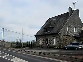 Town hall | |
Location of Tirepied-sur-Sée | |
 Tirepied-sur-Sée  Tirepied-sur-Sée | |
| Coordinates: 48°42′34″N 1°16′12″W / 48.7094°N 1.2699°W | |
| Country | France |
| Region | Normandy |
| Department | Manche |
| Arrondissement | Avranches |
| Canton | Isigny-le-Buat |
| Intercommunality | CA Mont-Saint-Michel-Normandie |
| Government | |
| • Mayor (2020–2026) | Thierry Lemoine[1] |
| Area 1 | 22.55 km2 (8.71 sq mi) |
| Population | 953 |
| • Density | 42/km2 (110/sq mi) |
| Time zone | UTC+01:00 (CET) |
| • Summer (DST) | UTC+02:00 (CEST) |
| INSEE/Postal code | 50597 /50870 |
| Elevation | 8–149 m (26–489 ft) |
| 1 French Land Register data, which excludes lakes, ponds, glaciers > 1 km2 (0.386 sq mi or 247 acres) and river estuaries. | |
Tirepied-sur-Sée (French pronunciation: [tiʁpje syʁ se], literally Tirepied on Sée) is a commune in the Manche department in Normandy in north-western France. It is the result of the merger, on 1 January 2019, of the communes of Tirepied and La Gohannière.[3]
See also
References
- ↑ "Répertoire national des élus: les maires" (in French). data.gouv.fr, Plateforme ouverte des données publiques françaises. 13 September 2022.
- ↑ "Populations légales 2021". The National Institute of Statistics and Economic Studies. 28 December 2023.
- ↑ Arrêté préfectoral (in French)
This article is issued from Wikipedia. The text is licensed under Creative Commons - Attribution - Sharealike. Additional terms may apply for the media files.