Saint-Laurent-de-Terregatte | |
|---|---|
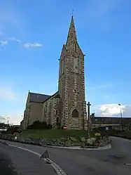 The church of Saint-Laurent | |
Location of Saint-Laurent-de-Terregatte | |
 Saint-Laurent-de-Terregatte  Saint-Laurent-de-Terregatte | |
| Coordinates: 48°34′23″N 1°15′28″W / 48.5731°N 1.2578°W | |
| Country | France |
| Region | Normandy |
| Department | Manche |
| Arrondissement | Avranches |
| Canton | Saint-Hilaire-du-Harcouët |
| Intercommunality | CA Mont-Saint-Michel-Normandie |
| Government | |
| • Mayor (2020–2026) | Loïc Bailleul[1] |
| Area 1 | 16.35 km2 (6.31 sq mi) |
| Population | 654 |
| • Density | 40/km2 (100/sq mi) |
| Time zone | UTC+01:00 (CET) |
| • Summer (DST) | UTC+02:00 (CEST) |
| INSEE/Postal code | 50500 /50240 |
| Elevation | 14–159 m (46–522 ft) (avg. 115 m or 377 ft) |
| 1 French Land Register data, which excludes lakes, ponds, glaciers > 1 km2 (0.386 sq mi or 247 acres) and river estuaries. | |
Saint-Laurent-de-Terregatte (French pronunciation: [sɛ̃ loʁɑ̃ də tɛʁɡat]) is a commune in the Manche department in Normandy in north-western France.[3] The commune is situated in the south of the Avranchin area. It is 6.5 km southeast of Ducey, 8.5 km northeast of Saint-James and 16 km west of Saint-Hilaire-du-Harcouët.
See also
References
- ↑ "Répertoire national des élus: les maires" (in French). data.gouv.fr, Plateforme ouverte des données publiques françaises. 13 September 2022.
- ↑ "Populations légales 2021". The National Institute of Statistics and Economic Studies. 28 December 2023.
- ↑ INSEE commune file
Wikimedia Commons has media related to Saint-Laurent-de-Terregatte.
This article is issued from Wikipedia. The text is licensed under Creative Commons - Attribution - Sharealike. Additional terms may apply for the media files.