La Pernelle | |
|---|---|
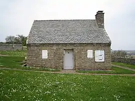 Town hall and former guardhouse | |
Location of La Pernelle | |
 La Pernelle  La Pernelle | |
| Coordinates: 49°37′14″N 1°17′51″W / 49.6206°N 1.2975°W | |
| Country | France |
| Region | Normandy |
| Department | Manche |
| Arrondissement | Cherbourg |
| Canton | Val-de-Saire |
| Intercommunality | CA Cotentin |
| Government | |
| • Mayor (2020–2026) | Nicole Branthomme[1] |
| Area 1 | 7.23 km2 (2.79 sq mi) |
| Population | 283 |
| • Density | 39/km2 (100/sq mi) |
| Time zone | UTC+01:00 (CET) |
| • Summer (DST) | UTC+02:00 (CEST) |
| INSEE/Postal code | 50395 /50630 |
| Elevation | 1–121 m (3.3–397.0 ft) (avg. 112 m or 367 ft) |
| 1 French Land Register data, which excludes lakes, ponds, glaciers > 1 km2 (0.386 sq mi or 247 acres) and river estuaries. | |
La Pernelle (French pronunciation: [la pɛʁnɛl]) is a commune in the Manche department in Normandy in north-western France.

La Pernelle, the panoramic view from the top of the hill
Places of interest
- The panorama from the top of the hill extends from coast West of the Phare de Gatteville to Saint-Vaast-la-Hougue and beyond, along the South-Eastern coast of the Manche department.
- The town hall is one of the smallest in France.
- The replica of the Grotto of Our Lady of Lourdes.

Eglise Sainte-Petronille de La Pernelle
See also
References
- ↑ "Répertoire national des élus: les maires" (in French). data.gouv.fr, Plateforme ouverte des données publiques françaises. 13 September 2022.
- ↑ "Populations légales 2021". The National Institute of Statistics and Economic Studies. 28 December 2023.
Wikimedia Commons has media related to La Pernelle.
This article is issued from Wikipedia. The text is licensed under Creative Commons - Attribution - Sharealike. Additional terms may apply for the media files.