Tessy-Bocage | |
|---|---|
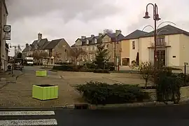 The market square in Tessy-sur-Vire | |
Location of Tessy-Bocage | |
 Tessy-Bocage  Tessy-Bocage | |
| Coordinates: 48°58′23″N 1°03′36″W / 48.973°N 1.060°W | |
| Country | France |
| Region | Normandy |
| Department | Manche |
| Arrondissement | Saint-Lô |
| Canton | Condé-sur-Vire |
| Intercommunality | Saint-Lô Agglo |
| Government | |
| • Mayor (2020–2026) | Michel Richard[1] |
| Area 1 | 34.24 km2 (13.22 sq mi) |
| Population | 2,223 |
| • Density | 65/km2 (170/sq mi) |
| Time zone | UTC+01:00 (CET) |
| • Summer (DST) | UTC+02:00 (CEST) |
| INSEE/Postal code | 50592 /50420 |
| 1 French Land Register data, which excludes lakes, ponds, glaciers > 1 km2 (0.386 sq mi or 247 acres) and river estuaries. | |
Tessy-Bocage (French pronunciation: [tɛsi bɔkaʒ]) is a commune in the department of Manche, northwestern France. The municipality was established on 1 January 2016 by merger of the former communes of Fervaches and Tessy-sur-Vire (the seat).[3] On 1 January 2018, the former commune of Pont-Farcy (part of the department of Calvados before 2018) was merged into it.[4]
Population
| Year | Pop. | ±% p.a. |
|---|---|---|
| 1968 | 2,502 | — |
| 1975 | 2,336 | −0.98% |
| 1982 | 2,246 | −0.56% |
| 1990 | 2,142 | −0.59% |
| 1999 | 2,224 | +0.42% |
| 2007 | 2,371 | +0.80% |
| 2012 | 2,369 | −0.02% |
| 2017 | 2,357 | −0.10% |
| Source: INSEE[5] | ||
See also
References
Wikimedia Commons has media related to Tessy-Bocage.
- ↑ "Répertoire national des élus: les maires" (in French). data.gouv.fr, Plateforme ouverte des données publiques françaises. 13 September 2022.
- ↑ "Populations légales 2021". The National Institute of Statistics and Economic Studies. 28 December 2023.
- ↑ Arrêté préfectoral 28 September 2015 (in French)
- ↑ Arrêté préfectoral 28 December 2017 (in French)
- ↑ Population en historique depuis 1968, INSEE
This article is issued from Wikipedia. The text is licensed under Creative Commons - Attribution - Sharealike. Additional terms may apply for the media files.