 | ||||
|---|---|---|---|---|
| 国道1号 | ||||
Japan National Route 1 highlighted in red | ||||
| Route information | ||||
| Length | 760.9 km[1] (472.8 mi) | |||
| Existed | 4 December 1952–present | |||
| Major junctions | ||||
| East end | ||||
| West end | ||||
| Location | ||||
| Country | Japan | |||
| Highway system | ||||
| ||||
National Route 1 (国道1号, Kokudō Ichi-gō) is a major highway on the island of Honshū in Japan. It connects Chūō, Tokyo in the Kantō region with the city of Osaka, Osaka Prefecture in the Kansai region, passing through the Chūbu region en route. It follows the old Tōkaidō westward from Tokyo to Kyoto, and the old Kyo Kaidō from there to Osaka. Between Tokyo and Aichi Prefecture it parallels the Tomei Expressway; from there to Mie Prefecture, the Higashi-Meihan Expressway, and from Shiga Prefecture to Osaka, the Meishin Expressway. It has a total length of 760.9 kilometers (472.8 mi). At its eastern terminus in Nihonbashi, Chūō, Tokyo, it meets National Routes 4, 6, 14, 15, 17, and 20. At its western terminus in Umeda, Kita-ku, Osaka, it links with Routes 2, 25, 26 and other highways.
National Route 1 links Tokyo to the important prefectural capitals of Yokohama (Kanagawa Prefecture), Shizuoka, Nagoya (Aichi Prefecture), Otsu (Shiga Prefecture), Kyoto, and Osaka.[2][3] It is the modern incarnation of the pre-modern Tōkaidō.
Route description

The main line of National Route 1 has a length of 638.4 kilometers (396.7 mi). When bypasses signed as National Route 1 are included, its total distance increases to 777.9 kilometers (483.4 mi).[4] Out of all of the national highways of Japan, it is the second longest land-based route after National Route 4,[5] though National Route 58 is the longest route when seabound routes are factored in.[6]
The highway's origin and eastern terminus lies at Nihonbashi in Tokyo's Chūō ward. At Nihonbashi it meets national routes 4, 6, 14, 15, 17, and 20. The highway passes through the cities of Kawasaki, Yokohama, Odawara, Numazu, Shizuoka, Hamamatsu, Nagoya, Yokkaichi, Ōtsu, and Kyoto. Its endpoint and western terminus lies in the Umeda district of Osaka's Kita ward. In Umeda, it has a junction with national routes 2, 26, 163, 165, 25, and 176.[4]
Overlapping sections
- In Chuo: Route 15
- From the origin to Chiyoda (Sakuradamon intersection): Route 20
- In Yokohama City, from Takashima-cho intersection to Hamamatsucho intersection: Route 16
- From Odawara City to Hakone Town (Miyanoshita intersection): Route 138
- From Hamamatsu City (Shinohara intersection) to Kosai City (Okurado IC): Route 42
History
National Route 1 was preceded by the Tōkaidō between Tokyo to Kyoto, and the old Kyo Kaidō from Kyoto to Osaka. The road's construction was order by the first shōgun of the Edo period, Tokugawa Ieyasu. It served to link the old capital of Japan, Kyoto, to Tokugawa's new capital, Edo. The Tōkaidō's post stations, known in Japanese as shukuba, were captured by the printmaker Utagawa Hiroshige in his ukiyo-e prints, The Fifty-three Stations of the Tōkaidō.[7]
In 1919, the first Road Act was passed, establishing a highway also called National Route 1 between Tokyo and the city of Shingū in Wakayama Prefecture partially along the current route.[8] On 4 December 1952 the route was designated by the Cabinet of Japan as Primary National Highway 1 between Tokyo and Osaka, establishing the highway almost entirely along its current routing. On 1 April 1965 the route was redesignated as General National Route 1.[9]
Junction list
All junctions listed are at-grade intersections unless noted otherwise.
| Prefecture | Location | km | mi | Destinations | Notes | |
|---|---|---|---|---|---|---|
| Tokyo | Chuo | Highway continues beyond eastern terminus as a concurrency of several national routes | ||||
| Nihonbashi Bridge (Inner Circular Route) | Eastern terminus of National Route 1; no direct access to Inner Circular Route | |||||
| Western end of National Route 15 concurrency | ||||||
| Chiyoda | Metropolitan Route 403 – Kitaikebekuro, Shibuya | |||||
| Metropolitan Route 404 | ||||||
| Metropolitan Route 406 | ||||||
| Metropolitan Route 304 | ||||||
| Metropolitan Route 301 – Kudanshita, Kokyomae | ||||||
| Western end of National Route 20 concurrency | ||||||
| Minato | Metropolitan Route 405 – Tameike, Shinbashi | |||||
| Metropolitan Route 319 – Roppongi | ||||||
| Metropolitan Route 301 / Metropolitan Route 319 | ||||||
| Metropolitan Route 305 – Ebisu / Metropolitan Route 415 – Tameike, Furukawabashi | ||||||
| Metropolitan Route 312 – Meguro | ||||||
| Shinagawa | Togoshi entrance and exit; entrance to northbound expressway, exit from southbound expressway | |||||
| Metropolitan Route 317 – Ohashi, Osaki | ||||||
| Metropolitan Route 317 – Shinagawa | ||||||
| Metropolitan Route 2 – Tengenjibashi | ||||||
| Metropolitan Route 420 – Musashikoyoma | ||||||
| Ota | Metropolitan Route 318 – Omori | |||||
| Metropolitan Route 421 | ||||||
| Metropolitan Route 311 – Kamata, Shimo-Maruko Station | ||||||
| Kanagawa | Kawasaki | |||||
| Prefectural Route 140 (Tomei Expressway) – Mizonokuchi, Kawasaki Station | ||||||
| Yokohama | Prefectural Route 14 – Tsunashima, Tsurumi Station | |||||
| Prefectural Route 2 – Tsunashima | ||||||
| Interchange; eastbound exit and westbound entrance | ||||||
| Prefectural Route 12 – Rokkakabushi | ||||||
| Eastern end of National Route 16 concurrency | ||||||
| Western end of National Route 16 concurrency | ||||||
| Prefectural Route 84 – Kamakura | ||||||
| Kariba Interchange | ||||||
| Prefectural Route 218 – Sakuragicho, Idogaya | ||||||
Prefectural Route 17 – Hino, Shin-Yokohama, Higashi-Totsuka Station | ||||||
Prefectural Route 401 – Seya | ||||||
| Prefectural Route 22 east – Kaminagaya | Eastern end of Kanagawa Prefecture Route 22 concurrency | |||||
| Western end of Kanagawa Prefecture Route 22 concurrency | ||||||
| Interchange; eastbound exit and westbound entrance | ||||||
| Prefectural Route 23 – Ofuna, Shonandai | Interchange | |||||
| Prefectural Route 30 – Enoshima, Fujisawa | Interchange westbound; at-grade intersection eastbound | |||||
| Fujisawa | Interchange; no exits | |||||
| Prefectural Route 43 – Atsugi, Yoda | ||||||
| No access from Shin-Shōnan Bypass to westbound National Route 1; Fujisawa Interchange | ||||||
| Chigasaki | Prefectural Route 44 (Old Tōkaidō) east – Enoshima | Eastern end of Kanagawa Prefecture Route 44 concurrency | ||||
| Prefectural Route 44 west – Atsugi, Isehara | Western end of Kanagawa Prefecture Route 44 concurrency | |||||
| Access only to eastbound traffic and from westbound traffic; Chigasaki-nishi Interchange | ||||||
| Hiratsuka | ||||||
| Prefectural Route 606 north – Hadano, Isehara | ||||||
| Oiso | Prefectural Route 62 – Hadano | Eastern end of Kanagawa Prefecture Route 62 concurrency | ||||
Prefectural Route 609 – Guzo | Western end of Kanagawa Prefecture Route 62 concurrency | |||||
| Seishō Bypass | ||||||
| Prefectural Route 63 – to Odawara-Atsugi Road, Isehara | ||||||
| Ninomiya | Prefectural Route 71 to Odawara-Atsugi Road / to Tomei Expressway – Hadano / Seisho Bypass | |||||
| Odawara | Prefectural Route 709 – Matsuda, Nakai | |||||
| Seishō Bypass – Tachikara, Yokohama | Interchange | |||||
| Prefectural Route 72 to Tomei Expressway – Matsuda / Seisho Bypass | ||||||
| Prefectural Route 719 / Seisho Bypass – Yokohama | ||||||
| Seishō Bypass – Odawara, Yokohama | Interchange | |||||
| Eastern end of unsigned National Route 138 concurrency | ||||||
| Seishō Bypass to Odawara-Atsugi Road / to Hakone Toll Road | Interchange | |||||
| Hakone | Hakone Bypass – Yugawara | |||||
| Prefectural Route 732 – Hatajuka | ||||||
| Western end of unsigned National Route 138 concurrency | ||||||
| Prefectural Route 723 – Gora | ||||||
| Prefectural Route 734 – Kojiri, Owakudani | ||||||
| Prefectural Route 75 – Gotenba, Sengokuhara | ||||||
| Prefectural Route 732 – Odawara, Hatajuka | ||||||
| Prefectural Route 75 to Hakone Toll Road – Yagawara | ||||||
| Interchange | ||||||
| Prefectural Route 20 – Atami / Ashinoko Skyline – Kojiri | ||||||
| Shizuoka | Mishima | Shin-Tomei Expressway – to Tōmei Expressway | ||||
| Prefectural Route 22 – Central Mishima | ||||||
| Prefectural Route 142 | ||||||
| Interchange | ||||||
| Prefectural Route 140 / Prefectural Route 51 – Mishima Station | ||||||
| Prefectural Route 144 | ||||||
| Prefectural Route 145 | ||||||
| Prefectural Route 380 | Interchange | |||||
| Numazu | ||||||
| Prefectural Route 162 – Numazu Station / Prefectural Route 22 | ||||||
| Prefectural Route 164 – Katahama Station | ||||||
| Prefectural Route 165 – Hara Station | ||||||
| Prefectural Route 166 | ||||||
| Fuji | Prefectural Route 167 | |||||
| Interchange | ||||||
| Prefectural Route 174 – Fujinomiya | ||||||
| Shizuoka | Fujikawa | Interchange | ||||
| Kanbara | Interchange | |||||
| Interchange | ||||||
| Prefectural Route 193 | ||||||
| Prefectural Route 338 to Seishin Bypass / to Tomei Expressway, Shin-Tomei Expressway / Miho, Shimizu Port | ||||||
| Prefectural Route 54 – to Tomei Expressway, Nuzamu / Prefectural Route 67 to Seishin Bypass – Hamamatsu | ||||||
| Prefectural Route 197 – Miho, Shimizu Port | ||||||
| Prefectural Route 354 – to Prefectural Route 384 | ||||||
| Prefectural Route 27 | ||||||
| Prefectural Route 207 / Prefectural Route 366 | ||||||
| Prefectural Route 208 | ||||||
| Interchange | ||||||
| Prefectural Route 208 (Utsunoya Pass) | ||||||
| Fujieda–Shizuoka border | Okabe Tunnel | |||||
| Fujieda | Hirohata Interchange | |||||
| Prefectural Route 209 – Central Fujieda, Asahina | Interchange | |||||
| Prefectural Route 215 – Nishigata, Central Fujieda | Interchange | |||||
| Prefectural Route 32 – Central Fujieda, Setonoya | Interchange | |||||
| Shimada | Interchange | |||||
| Central Shimada | Interchange | |||||
| Kawanehon | Interchange | |||||
| Interchange | ||||||
| Makinohara First Tunnel | ||||||
| Makinohara Second Tunnel | ||||||
| Makinohara Third Tunnel | ||||||
| Interchange | ||||||
| Prefectural Route 381 | ||||||
| Kakegawa | Sayononakayama Tunnel | |||||
| Prefectural Route 415 | ||||||
| Interchange | ||||||
| Kotonomama Tunnel | ||||||
| Interchange | ||||||
| Prefectural Route 39 – Kurami, Central Kakegawa | Interchange | |||||
| Prefectural Route 40 – Mori, Central Kakegawa | Interchange | |||||
| Fukuroi | Prefectural Route 253 – Harakawa | |||||
| Interchange; eastbound exit and westbound entrance | ||||||
| Prefectural Route 402 – Aino Station, ECOPA Stadium | ||||||
| Prefectural Route 413 – Central Fukuroi | ||||||
| Prefectural Route 61 to Tomei Expressway – Mori, Central Fukuroi | Interchange | |||||
| Central Fukuroi | Interchange | |||||
| Iwata | Interchange; westbound exit and eastbound entrance | |||||
| Prefectural Route 86 – Tomei Expressway, Central Iwata, Fukude Fishing Port | Interchange | |||||
| Prefectural Route 43 – Fukude, Central Iwata | ||||||
| Prefectural Route 44 – Tenryu, Iwata Station | Interchange | |||||
| Interchange | ||||||
| Prefectural Route 262 – Central Iwata | Interchange | |||||
| Hamamatsu | Prefectural Route 261 – Hamakita | Interchange | ||||
| Interchange | ||||||
| Prefectural Route 313 | ||||||
| Prefectural Route 316 – Maisaka Station | ||||||
| Prefectural Route 317 – Central Hamamatsu | ||||||
| Interchange; eastbound exit and westbound entrance | ||||||
| Prefectural Route 65 | ||||||
| Prefectural Route 49 – Toyohashi, Hosoe | ||||||
| Prefectural Route 49 | ||||||
| Kosai | Prefectural Route 323 – Kanzanji | |||||
| Interchange | ||||||
| Shiomi Tunnel | ||||||
| Aichi | Toyohashi | Prefectural Route 402 | ||||
| Prefectural Route 404 | ||||||
| Prefectural Route 3 / Prefectural Route 386 | ||||||
| Prefectural Route 31 | ||||||
| Prefectural Route 502 | ||||||
| Prefectural Route 69 | ||||||
| Prefectural Route 382 – Toyohashi Station / Prefectural Route 460 to Tomei Expressway – Toyokawa | ||||||
| Toyokawa | ||||||
| Prefectural Route 495 | ||||||
| Prefectural Route 373 | ||||||
| Prefectural Route 21 | ||||||
| Prefectural Route 31 | ||||||
| Prefectural Route 374 | ||||||
| Prefectural Route 5 / Prefectural Route 368 | ||||||
| Prefectural Route 374 | ||||||
| Okazaki | East end of National Route 473 concurrency | |||||
| West end of National Route 473 concurrency | ||||||
| Prefectural Route 329 | ||||||
| Prefectural Route 48 | ||||||
| Prefectural Route 35 | ||||||
| Tomei Expressway – Okazaki | Interchange | |||||
| Prefectural Route 477 – Higashi-Okazaki Station | ||||||
| Prefectural Route 39 – Asuke / Prefectural Route 483 – Kota | ||||||
| Prefectural Route 290 | ||||||
| Prefectural Route 47 – Central Anjo | ||||||
| Prefectural Route 26 – Nishio, Toyota | ||||||
| Anjo | Prefectural Route 76 – Central Anjo, Toyota | |||||
| Prefectural Route 12 – Toyota, Mikawa-Anjo Station | ||||||
| Chiryu | Kinuura-Toyota Road – Toyota, Takahama | Interchange | ||||
| Prefectural Route 51 | ||||||
| Interchange | ||||||
| Prefectural Route 54 | ||||||
| Prefectural Route 289 | ||||||
| Toyoake | Interchange; westbound exit and eastbound entrance | |||||
| Prefectural Route 57 – Seto, Tojo | Interchange; southbound traffic access only; no access to Prefectural Route 57 south | |||||
| Nagoya | Prefectural Route 222 | |||||
| Prefectural Route 243 – Obu / Arimatsu Station | ||||||
| Prefectural Route 50 | ||||||
| Airport Route – to National Route 41, Komaki, Tsuruma Park Prefectural Route 222 – National Highway Office | ||||||
| Prefectural Route 271 | ||||||
| Interchange | ||||||
| Prefectural Route 107 – Yaguma-dori / Kinjo Pier | ||||||
| Prefectural Route 70 | ||||||
| Prefectural Route 106 | ||||||
| Interchange | ||||||
| Kanie | Prefectural Route 103 – Central Kanie | |||||
| Prefectural Route 66 south Prefectural Route 114 north | ||||||
| Interchange | ||||||
| Prefectural Route 462 south | Eastern end of Aichi Prefecture Route 462 concurrency | |||||
| Aisai | Prefectural Route 462 north – Eiwa Station | Western end of Aichi Prefecture Route 462 concurrency | ||||
| Yatomi | Prefectural Route 109 – Aisai | |||||
Prefectural Route 105 south | Eastern end of Aichi Prefecture Route 105 concurrency | |||||
| Prefectural Route 29 / Prefectural Route 105 north | Western end of Aichi Prefecture Route 105 concurrency | |||||
| Prefectural Route 108 | ||||||
| Mie–Aichi border | Owari Bridge (east span) | |||||
| Mie | Kuwana | |||||
| Prefectural Route 518 west | ||||||
| Prefectural Route 106 north – Kaizu | ||||||
| Owari Bridge (west span) | ||||||
| Prefectural Route 613 south | ||||||
| Prefectural Route 504 east – Kuwana Post Office | ||||||
| Interchange | ||||||
| Asahi | Prefectural Route 143 | |||||
| Prefectural Route 66 | ||||||
| Interchange | ||||||
| Kawagoe | Prefectural Route 26 – Tōin | |||||
| Prefectural Route 401 | ||||||
| Prefectural Route 8 | ||||||
| Prefectural Route 64 to Higashi-Meihan Expressway / Prefectural Route 401 – Kasumigaura | ||||||
| Prefectural Route 9 | ||||||
| Yokkaichi | ||||||
| Prefectural Route 44 / Prefectural Route 629 | ||||||
| Prefectural Route 631 | ||||||
| Prefectural Route 407 | ||||||
| Prefectural Route 8 – Sasagawa, Central Suzuka / Kokubu | ||||||
| Suzuka | Prefectural Route 115 – Suzawa, Central Suzuka | |||||
| Prefectural Route 27 to Higashi-Meihan Expressway – Central Suzuka | ||||||
| Prefectural Route 637 / Central Suzuka, Suzuka Circuit | Interchange | |||||
| Prefectural Route 641 | ||||||
| Prefectural Route 78 | ||||||
| Kameyama | ||||||
| To Prefectural Route 647 | Interchange | |||||
| Prefectural Route 647 | Interchange | |||||
| Interchange | ||||||
| Prefectural Route 11 | ||||||
| Shiga–Mie border | Shizuka–Toge Tunnel | |||||
| Shiga | Koka | Prefectural Route 607 | ||||
| Prefectural Route 129 | ||||||
| Prefectural Route 9 | ||||||
| Prefectural Route 24 | ||||||
| Prefectural Route 24 / Prefectural Route 41 | ||||||
| Prefectural Route 183 | ||||||
| Interchange | ||||||
| Interchange; eastbound exit and westbound entrance | ||||||
| Prefectural Route 549 | ||||||
| Prefectural Route 537 | ||||||
| Prefectural Route 121 / Prefectural Route 164 | ||||||
| Prefectural Route 128 | ||||||
| Prefectural Route 178 | ||||||
| Konan | ||||||
| Prefectural Route 22 / Prefectural Route 113 | ||||||
| Prefectural Route 11 | ||||||
| Prefectural Route 12 / Prefectural Route 145 | ||||||
| Ritto–Konan border | Interchange | |||||
| Ritto | Eastern end of National Route 8 concurrency; interchange | |||||
| Prefectural Route 55 – Shigaraki | ||||||
| Prefectural Route 31 – Hamakaido / Shigaraki | ||||||
| Prefectural Route 2 – Moriyama | ||||||
| Kusatsu–Ritto border | Prefectural Route 142 | |||||
| Kusatsu | Prefectural Route 116 / Prefectural Route 143 | |||||
| Prefectural Route 28 | ||||||
| Prefectural Route 26 | ||||||
Prefectural Route 102 north (Kogan Road) | ||||||
| Prefectural Route 781 | ||||||
| Interchange | ||||||
| Kyoto | Kyoto | Prefectural Route 143 west – Okazaki | Kyoto-higashi Interchange (E1 exit 32) | |||
| Prefectural Route 35 – Keage, Shinomiza | ||||||
| Prefectural Route 117 – Yamashinaekimaen, Uji, Nara | ||||||
| Higashiyama Tunnel | ||||||
| Prefectural Route 116 (Shibutani Road) | ||||||
| Prefectural Route 143 – Nara | ||||||
| Prefectural Route 32 – Kyokawaramachi, Shimongo | ||||||
| Western end of National Route 8 concurrency, eastern end of National Route 9 concurrency | ||||||
Prefectural Route 38 north – Kamigamo | Western end of National Route 9 concurrency | |||||
| Prefectural Route 114 – Shichijo-omiya | ||||||
| Prefectural Route 201 | ||||||
| Kyoto-minami Interchange (E1 exit 33-1) | ||||||
| Prefectural Route 202 – Kogabashi | ||||||
| Prefectural Route 13 – Takedakaido / Prefectural Route 35 – Yodo | ||||||
| Prefectural Route 188 – Kongetsukyo, Nagokakyo | ||||||
| Prefectural Route 124 | ||||||
| Prefectural Route 15 – Uji, Yodo | ||||||
| Yawata | Prefectural Route 22 – Uji, Yodo | |||||
| Prefectural Route 281 – Central Yawata | ||||||
| Prefectural Route 736 – Kyotanabe / Central Yawata | ||||||
| Prefectural Route 251 – Kyotanabe / Prefectural Route 735 – Central Yawata | ||||||
| Prefectural Route 735 – Nagao | ||||||
| Prefectural Route 284 – Kyotanabe, Central Yawata | ||||||
| Osaka | Hirakata | Prefectural Route 735 | ||||
| Prefectural Route 144 – Nagao, Central Hirakata | ||||||
| Prefectural Route 18 – Makino | ||||||
| Interchange eastbound; at-grade intersection westbound; east end of National Route 170 concurrency | ||||||
| Interchange westbound; at-grade intersection eastbound; west end of National Route 170 concurrency | ||||||
| Prefectural Route 13 | ||||||
| Neyagawa | Prefectural Route 148 – Kadono / Prefectural Route 149 | |||||
| Prefectural Route 19 | ||||||
| Prefectural Route 15 – Settsu | ||||||
| Moriguchi | ||||||
| Prefectural Route 2 – to Dainikahan Expressway, Sakai / Prefectural Route 13 – Neyagawa | ||||||
| Osaka | Prefectural Route 155 – Yoigumo / Prefectural Route 158 – Kadoma | |||||
| Prefectural Route 8 – Nara, Daito | ||||||
| Sakuranomiya Bridge | ||||||
| Prefectural Route 30 – Tennoji Station / Hinokuchicho | ||||||
| Western terminus of National Route 1; highway continues west as National Route 2 | ||||||
1.000 mi = 1.609 km; 1.000 km = 0.621 mi
| ||||||
See also
- Gokishichidō, the ancient highways of Japan
Gallery
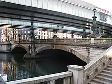 Nihonbashi, Tokyo terminus
 Route 1 passes in front of the Imperial Palace in Tokyo.
 Western terminus of Route 1 in Umeda
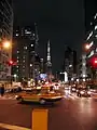 Route 1 heading through Shiba towards Tokyo Tower
References
- ↑ "一般国道の路線別、都道府県別道路現況" [Road statistics by General National Highway route and prefecture] (PDF) (in Japanese). Ministry of Land, Infrastructure, Transport and Tourism. Retrieved 15 May 2020.
- ↑ 一般国道1号 (in Japanese). Kinki Regional Development Bureau, Ministry of Land, Infrastructure, Transport and Tourism. Retrieved 26 November 2010.
- ↑ 一般国道1号 (in Japanese). Kinki Regional Development Bureau, Ministry of Land, Infrastructure, Transport and Tourism. Retrieved 26 November 2010.
- 1 2 "一般国道の路線別、都道府県別道路現況" (PDF) (in Japanese). Ministry of Land, Infrastructure, Transport and Tourism. Retrieved 17 December 2020.
- ↑ "起点から終点まで走ったことはある? "長距離国道"TOP3" [Have you ever driven from the origin to the end? Top 3 "Long-distance national highways"] (in Japanese). Toyo Tire Corporation. 26 July 2019. Retrieved 18 December 2020.
- ↑ "身近な道路が実は"日本一"!?日本一の国道を走ろう!(その1)" [The familiar road is actually the best in Japan!? Let's drive on the best national road in Japan! (Part 1)]. On the Road (in Japanese). Toyo Tire Corporation. 29 October 2019. Retrieved 1 September 2020.
- ↑ Leanne (8 May 2020). "Travelling Hiroshige's "The 53 Stations of Tokaido" Road". Voyagpon. Retrieved 18 December 2020.
- ↑ "東海道の起源" [Origin of the Tōkaidō] (in Japanese). Shizuoka National Highway Office. 12 March 2020. Retrieved 12 December 2020.
- ↑ "一般国道の路線を指定する政令" [Cabinet Order Designating General National Routes]. Act of 1965 (in Japanese). Cabinet of Japan. Retrieved 12 December 2020 – via Wikisource.
External links
 Media related to Category:Route 1 (Japan) at Wikimedia Commons