Nohèdes
Noedes | |
|---|---|
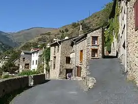 The road into Nohèdes | |
Location of Nohèdes | |
 Nohèdes  Nohèdes | |
| Coordinates: 42°37′26″N 2°17′23″E / 42.6239°N 2.2897°E | |
| Country | France |
| Region | Occitania |
| Department | Pyrénées-Orientales |
| Arrondissement | Prades |
| Canton | Les Pyrénées catalanes |
| Government | |
| • Mayor (2020–2026) | Thierry Begue[1] |
| Area 1 | 30.91 km2 (11.93 sq mi) |
| Population | 60 |
| • Density | 1.9/km2 (5.0/sq mi) |
| Time zone | UTC+01:00 (CET) |
| • Summer (DST) | UTC+02:00 (CEST) |
| INSEE/Postal code | 66122 /66500 |
| Elevation | 758–2,459 m (2,487–8,068 ft) (avg. 995 m or 3,264 ft) |
| 1 French Land Register data, which excludes lakes, ponds, glaciers > 1 km2 (0.386 sq mi or 247 acres) and river estuaries. | |
Nohèdes (French pronunciation: [nɔɛd] ⓘ; Catalan: Noedes) is a commune in the Pyrénées-Orientales department in southern France.
Geography
Nohèdes is located in the canton of Les Pyrénées catalanes and in the arrondissement of Prades.
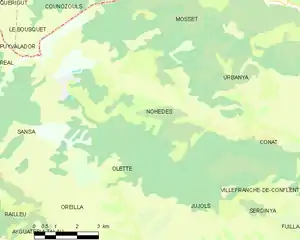
Map of Nohèdes and its surrounding communes
Population
| Year | Pop. | ±% p.a. |
|---|---|---|
| 1968 | 21 | — |
| 1975 | 23 | +1.31% |
| 1982 | 26 | +1.77% |
| 1990 | 55 | +9.82% |
| 1999 | 62 | +1.34% |
| 2007 | 71 | +1.71% |
| 2012 | 65 | −1.75% |
| 2017 | 63 | −0.62% |
| Source: INSEE[3] | ||
See also
References
- ↑ "Répertoire national des élus: les maires" (in French). data.gouv.fr, Plateforme ouverte des données publiques françaises. 13 September 2022.
- ↑ "Populations légales 2021". The National Institute of Statistics and Economic Studies. 28 December 2023.
- ↑ Population en historique depuis 1968, INSEE
Wikimedia Commons has media related to Nohèdes.
This article is issued from Wikipedia. The text is licensed under Creative Commons - Attribution - Sharealike. Additional terms may apply for the media files.