Sansa | |
|---|---|
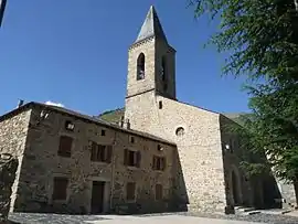 The town hall and new church, in Sansa | |
Location of Sansa | |
 Sansa  Sansa | |
| Coordinates: 42°36′11″N 2°10′27″E / 42.6031°N 2.1742°E | |
| Country | France |
| Region | Occitania |
| Department | Pyrénées-Orientales |
| Arrondissement | Prades |
| Canton | Les Pyrénées catalanes |
| Government | |
| • Mayor (2020–2026) | Antoine Tahoces[1] |
| Area 1 | 22.27 km2 (8.60 sq mi) |
| Population | 27 |
| • Density | 1.2/km2 (3.1/sq mi) |
| Time zone | UTC+01:00 (CET) |
| • Summer (DST) | UTC+02:00 (CEST) |
| INSEE/Postal code | 66191 /66360 |
| Elevation | 1,155–2,459 m (3,789–8,068 ft) (avg. 1,400 m or 4,600 ft) |
| 1 French Land Register data, which excludes lakes, ponds, glaciers > 1 km2 (0.386 sq mi or 247 acres) and river estuaries. | |
Sansa (French pronunciation: [sɑ̃sa] ⓘ; Catalan: Censà) is a commune in the Pyrénées-Orientales department in southern France.[3]
Geography
Sansa is located in the canton of Les Pyrénées catalanes and in the arrondissement of Prades.
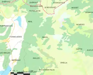
Map of Sansa and its surrounding communes
Population
| Year | Pop. | ±% p.a. |
|---|---|---|
| 1968 | 14 | — |
| 1975 | 5 | −13.68% |
| 1982 | 6 | +2.64% |
| 1990 | 7 | +1.95% |
| 1999 | 7 | +0.00% |
| 2007 | 19 | +13.29% |
| 2012 | 29 | +8.83% |
| 2017 | 22 | −5.38% |
| Source: INSEE[4] | ||
See also
References
- ↑ "Répertoire national des élus: les maires". data.gouv.fr, Plateforme ouverte des données publiques françaises (in French). 2 December 2020.
- ↑ "Populations légales 2021". The National Institute of Statistics and Economic Studies. 28 December 2023.
- ↑ INSEE commune file
- ↑ Population en historique depuis 1968, INSEE
Wikimedia Commons has media related to Sansa, Pyrénées-Orientales.
This article is issued from Wikipedia. The text is licensed under Creative Commons - Attribution - Sharealike. Additional terms may apply for the media files.