Palau-del-Vidre | |
|---|---|
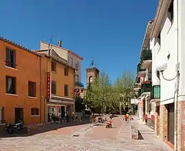 Town centre of Palau-del-Vidre | |
 Coat of arms | |
Location of Palau-del-Vidre | |
 Palau-del-Vidre  Palau-del-Vidre | |
| Coordinates: 42°34′26″N 2°57′43″E / 42.5739°N 2.9619°E | |
| Country | France |
| Region | Occitania |
| Department | Pyrénées-Orientales |
| Arrondissement | Céret |
| Canton | La Côte Vermeille |
| Intercommunality | CC des Albères, de la Côte Vermeille et de l'Illibéris |
| Government | |
| • Mayor (2020–2026) | Bruno Galan[1] |
| Area 1 | 10.41 km2 (4.02 sq mi) |
| Population | 3,135 |
| • Density | 300/km2 (780/sq mi) |
| Time zone | UTC+01:00 (CET) |
| • Summer (DST) | UTC+02:00 (CEST) |
| INSEE/Postal code | 66133 /66690 |
| Elevation | 9–46 m (30–151 ft) (avg. 19 m or 62 ft) |
| 1 French Land Register data, which excludes lakes, ponds, glaciers > 1 km2 (0.386 sq mi or 247 acres) and river estuaries. | |
Palau-del-Vidre (French pronunciation: [palo dɛl vidʁ] ⓘ; Catalan: Palau del Vidre) is a commune in the Pyrénées-Orientales department in southern France.
Geography
Palau-del-Vidre is located in the canton of La Côte Vermeille and in the arrondissement of Céret.

Map of Palau-del-Vidre and its surrounding communes
Population
| Year | Pop. | ±% p.a. |
|---|---|---|
| 1968 | 1,330 | — |
| 1975 | 1,417 | +0.91% |
| 1982 | 1,738 | +2.96% |
| 1990 | 2,004 | +1.80% |
| 1999 | 2,117 | +0.61% |
| 2007 | 2,607 | +2.64% |
| 2012 | 3,052 | +3.20% |
| 2017 | 3,142 | +0.58% |
| Source: INSEE[3] | ||
See also
References
- ↑ "Répertoire national des élus: les maires" (in French). data.gouv.fr, Plateforme ouverte des données publiques françaises. 13 September 2022.
- ↑ "Populations légales 2021". The National Institute of Statistics and Economic Studies. 28 December 2023.
- ↑ Population en historique depuis 1968, INSEE
Wikimedia Commons has media related to Palau-del-Vidre.
This article is issued from Wikipedia. The text is licensed under Creative Commons - Attribution - Sharealike. Additional terms may apply for the media files.