Saint-Martin-d'Ary | |
|---|---|
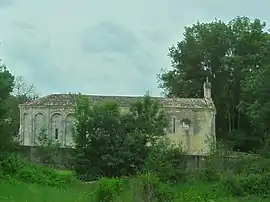 The church in Saint-Martin-d'Ary | |
Location of Saint-Martin-d'Ary | |
 Saint-Martin-d'Ary  Saint-Martin-d'Ary | |
| Coordinates: 45°13′36″N 0°12′47″W / 45.2267°N 0.2131°W | |
| Country | France |
| Region | Nouvelle-Aquitaine |
| Department | Charente-Maritime |
| Arrondissement | Jonzac |
| Canton | Les Trois Monts |
| Intercommunality | Haute-Saintonge |
| Government | |
| • Mayor (2020–2026) | Jean-Marc Paillé[1] |
| Area 1 | 8.61 km2 (3.32 sq mi) |
| Population | 471 |
| • Density | 55/km2 (140/sq mi) |
| Time zone | UTC+01:00 (CET) |
| • Summer (DST) | UTC+02:00 (CEST) |
| INSEE/Postal code | 17365 /17270 |
| Elevation | 39–102 m (128–335 ft) (avg. 82 m or 269 ft) |
| 1 French Land Register data, which excludes lakes, ponds, glaciers > 1 km2 (0.386 sq mi or 247 acres) and river estuaries. | |
Saint-Martin-d'Ary (French pronunciation: [sɛ̃ maʁtɛ̃ daʁi]) is a commune in the Charente-Maritime department in southwestern France. There are three parts that make up Saint-Martin-d'Ary. People who live there are called Saint-Martinois and the Saint-Martinoises. The church and its town hall, the town hall and school located at Les Sables, and a suburb bordering Montguyon
Population
| Year | Pop. | ±% |
|---|---|---|
| 1962 | 458 | — |
| 1968 | 466 | +1.7% |
| 1975 | 476 | +2.1% |
| 1982 | 443 | −6.9% |
| 1990 | 483 | +9.0% |
| 1999 | 479 | −0.8% |
| 2008 | 504 | +5.2% |
See also
References
- ↑ "Répertoire national des élus: les maires". data.gouv.fr, Plateforme ouverte des données publiques françaises (in French). 9 August 2021.
- ↑ "Populations légales 2021". The National Institute of Statistics and Economic Studies. 28 December 2023.
External links
 Media related to Saint-Martin-d'Ary at Wikimedia Commons
This article is issued from Wikipedia. The text is licensed under Creative Commons - Attribution - Sharealike. Additional terms may apply for the media files.