Échalou | |
|---|---|
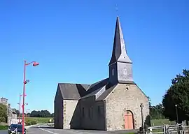 The church in Échalou | |
Location of Échalou | |
 Échalou  Échalou | |
| Coordinates: 48°43′43″N 0°29′31″W / 48.7286°N 0.4919°W | |
| Country | France |
| Region | Normandy |
| Department | Orne |
| Arrondissement | Argentan |
| Canton | La Ferté-Macé |
| Intercommunality | CA Flers Agglo |
| Government | |
| • Mayor (2020–2026) | Claude Gasnier[1] |
| Area 1 | 5.59 km2 (2.16 sq mi) |
| Population | 350 |
| • Density | 63/km2 (160/sq mi) |
| Time zone | UTC+01:00 (CET) |
| • Summer (DST) | UTC+02:00 (CEST) |
| INSEE/Postal code | 61149 /61440 |
| Elevation | 204–237 m (669–778 ft) (avg. 217 m or 712 ft) |
| 1 French Land Register data, which excludes lakes, ponds, glaciers > 1 km2 (0.386 sq mi or 247 acres) and river estuaries. | |
Échalou (French pronunciation: [eʃalu] ⓘ) is a commune in the Orne department in north-western France.
Geography
The commune is made up of the following collection of villages and hamlets, Les Mézerets,La Foucaudière, La Crilloire, La Graindorgère and Échalou.[3]
There are 2 watercourses that traverse through the commune, the river Varenne and a stream called the Loget.[4]
Neighbouring communes[3] | |
|---|---|
See also
References
- ↑ "Répertoire national des élus: les maires". data.gouv.fr, Plateforme ouverte des données publiques françaises (in French). 2 December 2020.
- ↑ "Populations légales 2021". The National Institute of Statistics and Economic Studies. 28 December 2023.
- 1 2 "Échalou · 61440, France". Échalou · 61440, France.
- ↑ "Mairie d'Échalou et sa commune (61440)". Annuaire-Mairie. 4 September 2023.
Wikimedia Commons has media related to Échalou.
This article is issued from Wikipedia. The text is licensed under Creative Commons - Attribution - Sharealike. Additional terms may apply for the media files.