Saint-Pierre-la-Bruyère | |
|---|---|
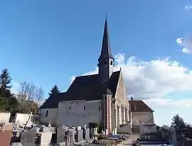 The church in Saint-Pierre-la-Bruyère | |
Location of Saint-Pierre-la-Bruyère | |
 Saint-Pierre-la-Bruyère  Saint-Pierre-la-Bruyère | |
| Coordinates: 48°21′47″N 0°48′21″E / 48.3631°N 0.8058°E | |
| Country | France |
| Region | Normandy |
| Department | Orne |
| Arrondissement | Mortagne-au-Perche |
| Canton | Bretoncelles |
| Government | |
| • Mayor (2021–2026) | Bruno Goupy[1] |
| Area 1 | 6.33 km2 (2.44 sq mi) |
| Population | 433 |
| • Density | 68/km2 (180/sq mi) |
| Time zone | UTC+01:00 (CET) |
| • Summer (DST) | UTC+02:00 (CEST) |
| INSEE/Postal code | 61448 /61340 |
| Elevation | 130–216 m (427–709 ft) (avg. 115 m or 377 ft) |
| 1 French Land Register data, which excludes lakes, ponds, glaciers > 1 km2 (0.386 sq mi or 247 acres) and river estuaries. | |
Saint-Pierre-la-Bruyère (French pronunciation: [sɛ̃ pjɛʁ la bʁɥijɛʁ] ⓘ) is a commune in the Orne department in north-western France.[3]
See also
References
- ↑ "Répertoire national des élus: les maires" (in French). data.gouv.fr, Plateforme ouverte des données publiques françaises. 4 May 2022.
- ↑ "Populations légales 2021". The National Institute of Statistics and Economic Studies. 28 December 2023.
- ↑ INSEE commune file
Wikimedia Commons has media related to Saint-Pierre-la-Bruyère.
This article is issued from Wikipedia. The text is licensed under Creative Commons - Attribution - Sharealike. Additional terms may apply for the media files.