Champosoult | |
|---|---|
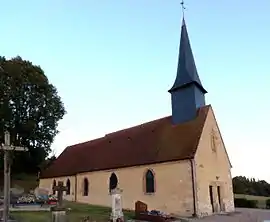 The church in Champosoult | |
Location of Champosoult | |
 Champosoult  Champosoult | |
| Coordinates: 48°52′16″N 0°10′18″E / 48.8711°N 0.1717°E | |
| Country | France |
| Region | Normandy |
| Department | Orne |
| Arrondissement | Mortagne-au-Perche |
| Canton | Vimoutiers |
| Intercommunality | Vallées d'Auge et du Merlerault |
| Government | |
| • Mayor (2020–2026) | Bernard Chrétien[1] |
| Area 1 | 7.01 km2 (2.71 sq mi) |
| Population | 99 |
| • Density | 14/km2 (37/sq mi) |
| Demonym | Champosulfiens |
| Time zone | UTC+01:00 (CET) |
| • Summer (DST) | UTC+02:00 (CEST) |
| INSEE/Postal code | 61089 /61120 |
| Elevation | 140–259 m (459–850 ft) (avg. 215 m or 705 ft) |
| 1 French Land Register data, which excludes lakes, ponds, glaciers > 1 km2 (0.386 sq mi or 247 acres) and river estuaries. | |
Champosoult (French pronunciation: [ʃɑ̃pozu]) is a commune in the Orne department in north-western France.
Geography
The commune has two streams running through its borders, the Costillets and the Besion.[3]
Neighbouring communes[4] | ||||||||||||||||
|---|---|---|---|---|---|---|---|---|---|---|---|---|---|---|---|---|
| ||||||||||||||||
See also
References
- ↑ "Répertoire national des élus: les maires". data.gouv.fr, Plateforme ouverte des données publiques françaises (in French). 2 December 2020.
- ↑ "Populations légales 2021". The National Institute of Statistics and Economic Studies. 28 December 2023.
- ↑ "Mairie de Champosoult et sa commune (61120)". Annuaire-Mairie. 26 April 2023.
- ↑ "Champosoult · 61120, France". Champosoult · 61120, France.
Wikimedia Commons has media related to Champosoult.
Wikivoyage has a travel guide for Champosoult.
This article is issued from Wikipedia. The text is licensed under Creative Commons - Attribution - Sharealike. Additional terms may apply for the media files.