Semallé | |
|---|---|
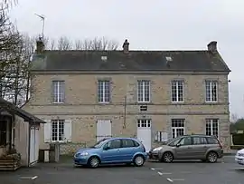 The town hall in Semallé | |
Location of Semallé | |
 Semallé  Semallé | |
| Coordinates: 48°28′32″N 0°09′03″E / 48.4756°N 0.1508°E | |
| Country | France |
| Region | Normandy |
| Department | Orne |
| Arrondissement | Alençon |
| Canton | Écouves |
| Intercommunality | CU Alençon |
| Government | |
| • Mayor (2020–2026) | Jean-Patrick Leroux[1] |
| Area 1 | 14.04 km2 (5.42 sq mi) |
| Population | 348 |
| • Density | 25/km2 (64/sq mi) |
| Time zone | UTC+01:00 (CET) |
| • Summer (DST) | UTC+02:00 (CEST) |
| INSEE/Postal code | 61467 /61250 |
| Elevation | 132–163 m (433–535 ft) (avg. 147 m or 482 ft) |
| 1 French Land Register data, which excludes lakes, ponds, glaciers > 1 km2 (0.386 sq mi or 247 acres) and river estuaries. | |
Semallé (French pronunciation: [səmale] ⓘ) is a commune in the Orne department in north-western France.
Points of Interest
- Maison de sainte Thérèse is the house that Thérèse of Lisieux stayed at as a child between March 1873 and April 1874.[3] The house today is set-up as a replica of what it would have been during this time.[4]
See also
References
- ↑ "Répertoire national des élus: les maires". data.gouv.fr, Plateforme ouverte des données publiques françaises (in French). 2 December 2020.
- ↑ "Populations légales 2021". The National Institute of Statistics and Economic Studies. 28 December 2023.
- ↑ "Semallé. La maison où la future Sainte-Thérèse a retrouvé la santé". actu.fr. 17 August 2019.
- ↑ HOUDAYER, par Nathalie (17 May 2017). "À Semallé, la maison de la nourrice de sainte Thérèse se visite". Ouest-France.fr.
Wikimedia Commons has media related to Semallé.
This article is issued from Wikipedia. The text is licensed under Creative Commons - Attribution - Sharealike. Additional terms may apply for the media files.