Arzal
Arzhal | |
|---|---|
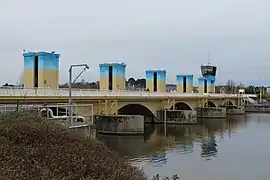 The Arzal Dam | |
Location of Arzal | |
 Arzal  Arzal | |
| Coordinates: 47°31′03″N 2°22′30″W / 47.5175°N 2.375°W | |
| Country | France |
| Region | Brittany |
| Department | Morbihan |
| Arrondissement | Vannes |
| Canton | Muzillac |
| Intercommunality | CC Arc Sud Bretagne |
| Government | |
| • Mayor (2020–2026) | Samuel Féret[1] |
| Area 1 | 23.44 km2 (9.05 sq mi) |
| Population | 1,742 |
| • Density | 74/km2 (190/sq mi) |
| Time zone | UTC+01:00 (CET) |
| • Summer (DST) | UTC+02:00 (CEST) |
| INSEE/Postal code | 56004 /56190 |
| Elevation | 0–62 m (0–203 ft) |
| 1 French Land Register data, which excludes lakes, ponds, glaciers > 1 km2 (0.386 sq mi or 247 acres) and river estuaries. | |
Arzal (French pronunciation: [aʁzal]; Breton: Arzhal) is a commune in the Morbihan department in the Brittany region in northwestern France.
Population
Inhabitants of Arzal are called Arzalais.
See also
References
- ↑ "Répertoire national des élus: les maires" (in French). data.gouv.fr, Plateforme ouverte des données publiques françaises. 13 September 2022.
- ↑ "Populations légales 2021". The National Institute of Statistics and Economic Studies. 28 December 2023.
External links
Wikimedia Commons has media related to Arzal.
- Official website (in French)
- Base Mérimée: Search for heritage in the commune, Ministère français de la Culture. (in French)
- Mayors of Morbihan Association (in French)
This article is issued from Wikipedia. The text is licensed under Creative Commons - Attribution - Sharealike. Additional terms may apply for the media files.