Riantec
Rianteg | |
|---|---|
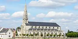 The church in Riantec | |
.svg.png.webp) Coat of arms | |
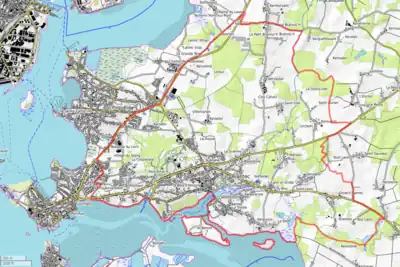
Location of Riantec | |
 Riantec  Riantec | |
| Coordinates: 47°42′42″N 3°18′33″W / 47.7117°N 3.3092°W | |
| Country | France |
| Region | Brittany |
| Department | Morbihan |
| Arrondissement | Lorient |
| Canton | Hennebont |
| Intercommunality | Lorient Agglomération |
| Government | |
| • Mayor (2020–2026) | Jean-Michel Bonhomme[1] |
| Area 1 | 14.06 km2 (5.43 sq mi) |
| Population | 5,772 |
| • Density | 410/km2 (1,100/sq mi) |
| Time zone | UTC+01:00 (CET) |
| • Summer (DST) | UTC+02:00 (CEST) |
| INSEE/Postal code | 56193 /56670 |
| Elevation | 0–35 m (0–115 ft) |
| 1 French Land Register data, which excludes lakes, ponds, glaciers > 1 km2 (0.386 sq mi or 247 acres) and river estuaries. | |
Riantec (French pronunciation: [ʁjɑ̃tɛk]; Breton: Rianteg) is a commune in the Morbihan department of Brittany in north-western France.[3]
Geography
The village sits on "La Petite Mer de Gavre" (french, The Small Sea of Gavre) with fine views across the bay.
Map
Population
Inhabitants of Riantec are called in French Riantécois.
| Year | Pop. | ±% p.a. |
|---|---|---|
| 1968 | 4,126 | — |
| 1975 | 4,128 | +0.01% |
| 1982 | 4,616 | +1.61% |
| 1990 | 4,846 | +0.61% |
| 1999 | 4,765 | −0.19% |
| 2007 | 4,958 | +0.50% |
| 2012 | 5,175 | +0.86% |
| 2017 | 5,622 | +1.67% |
| Source: INSEE[4] | ||
See also
References
- ↑ "Maires du Morbihan" (PDF). Préfecture du Morbihan. 7 July 2020.
- ↑ "Populations légales 2021". The National Institute of Statistics and Economic Studies. 28 December 2023.
- ↑ INSEE commune file
- ↑ Population en historique depuis 1968, INSEE
External links
Wikimedia Commons has media related to Riantec.
- Official website (in French)
- Mayors of Morbihan Association (in French)
This article is issued from Wikipedia. The text is licensed under Creative Commons - Attribution - Sharealike. Additional terms may apply for the media files.