Saint-Guyomard
Sant-Gwioñvarc'h | |
|---|---|
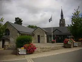 The town hall in Saint-Guyomard | |
.svg.png.webp) Coat of arms | |
Location of Saint-Guyomard | |
 Saint-Guyomard  Saint-Guyomard | |
| Coordinates: 47°46′54″N 2°30′45″W / 47.7817°N 2.5125°W | |
| Country | France |
| Region | Brittany |
| Department | Morbihan |
| Arrondissement | Vannes |
| Canton | Moréac |
| Intercommunality | CC de l'Oust à Brocéliande |
| Government | |
| • Mayor (2020–2026) | Maurice Braud[1] |
| Area 1 | 19.66 km2 (7.59 sq mi) |
| Population | 1,426 |
| • Density | 73/km2 (190/sq mi) |
| Time zone | UTC+01:00 (CET) |
| • Summer (DST) | UTC+02:00 (CEST) |
| INSEE/Postal code | 56219 /56460 |
| Elevation | 20–108 m (66–354 ft) |
| 1 French Land Register data, which excludes lakes, ponds, glaciers > 1 km2 (0.386 sq mi or 247 acres) and river estuaries. | |
Saint-Guyomard (French pronunciation: [sɛ̃ ɡɥijɔmaʁ]; Breton: Sant-Gwioñvarc'h) is a commune in the Morbihan department of Brittany in north-western France.[3]
Demographics
Inhabitants of Saint-Guyomard are called in French Guyomardais. The official population in 2019 was 1,389.[4]
See also
References
- ↑ "Maires du Morbihan" (PDF). Préfecture du Morbihan. 7 July 2020.
- ↑ "Populations légales 2021". The National Institute of Statistics and Economic Studies. 28 December 2023.
- ↑ Commune de Saint-Guyomard (56219), INSEE
- ↑ Populations légales 2019: 56 Morbihan, INSEE
External links
Wikimedia Commons has media related to Saint-Guyomard.
- Base Mérimée: Search for heritage in the commune, Ministère français de la Culture. (in French)
- Mayors of Morbihan Association (in French)
This article is issued from Wikipedia. The text is licensed under Creative Commons - Attribution - Sharealike. Additional terms may apply for the media files.