Le Sourn
Ar Sorn | |
|---|---|
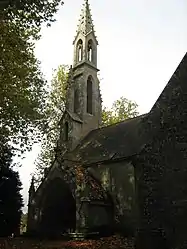 The chapel of Saint-Michel, in Le Sourn | |
Location of Le Sourn | |
 Le Sourn  Le Sourn | |
| Coordinates: 48°02′37″N 2°59′19″W / 48.0436°N 2.9886°W | |
| Country | France |
| Region | Brittany |
| Department | Morbihan |
| Arrondissement | Pontivy |
| Canton | Pontivy |
| Intercommunality | Pontivy Communauté |
| Government | |
| • Mayor (2020–2026) | Jean-Jacques Videlo[1] |
| Area 1 | 16.05 km2 (6.20 sq mi) |
| Population | 2,135 |
| • Density | 130/km2 (340/sq mi) |
| Time zone | UTC+01:00 (CET) |
| • Summer (DST) | UTC+02:00 (CEST) |
| INSEE/Postal code | 56246 /56300 |
| Elevation | 46–184 m (151–604 ft) |
| 1 French Land Register data, which excludes lakes, ponds, glaciers > 1 km2 (0.386 sq mi or 247 acres) and river estuaries. | |
Le Sourn (French pronunciation: [lə suʁn]; Occitan: Ar Sorn) is a commune in the Morbihan department of Brittany in north-western France.[3]
Population
| Year | Pop. | ±% p.a. |
|---|---|---|
| 1968 | 1,008 | — |
| 1975 | 1,246 | +3.07% |
| 1982 | 1,589 | +3.53% |
| 1990 | 1,790 | +1.50% |
| 1999 | 1,843 | +0.32% |
| 2007 | 2,002 | +1.04% |
| 2012 | 2,056 | +0.53% |
| 2017 | 2,107 | +0.49% |
| Source: INSEE[4] | ||
Inhabitants of Le Sourn are called in French Sournais.
See also
References
- ↑ "Maires du Morbihan" (PDF). Préfecture du Morbihan. 7 July 2020.
- ↑ "Populations légales 2021". The National Institute of Statistics and Economic Studies. 28 December 2023.
- ↑ INSEE commune file
- ↑ Population en historique depuis 1968, INSEE
External links
Wikimedia Commons has media related to Le Sourn.
- Official website (in French)
- Base Mérimée: Search for heritage in the commune, Ministère français de la Culture. (in French)
- Mayors of Morbihan Association (in French)
This article is issued from Wikipedia. The text is licensed under Creative Commons - Attribution - Sharealike. Additional terms may apply for the media files.