Hanches | |
|---|---|
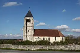 The church in Hanches | |
 Coat of arms | |
Location of Hanches | |
 Hanches  Hanches | |
| Coordinates: 48°36′11″N 1°38′52″E / 48.6031°N 1.6478°E | |
| Country | France |
| Region | Centre-Val de Loire |
| Department | Eure-et-Loir |
| Arrondissement | Chartres |
| Canton | Épernon |
| Government | |
| • Mayor (2020–2026) | Jean-Pierre Ruault[1] |
| Area 1 | 16.04 km2 (6.19 sq mi) |
| Population | 2,683 |
| • Density | 170/km2 (430/sq mi) |
| Time zone | UTC+01:00 (CET) |
| • Summer (DST) | UTC+02:00 (CEST) |
| INSEE/Postal code | 28191 /28130 |
| Elevation | 107–165 m (351–541 ft) |
| 1 French Land Register data, which excludes lakes, ponds, glaciers > 1 km2 (0.386 sq mi or 247 acres) and river estuaries. | |
Hanches (French pronunciation: [ɑ̃ʃ] ⓘ) is a commune in the Eure-et-Loir department in northern France.
Population
| Year | Pop. | ±% p.a. |
|---|---|---|
| 1968 | 709 | — |
| 1975 | 1,206 | +7.88% |
| 1982 | 1,524 | +3.40% |
| 1990 | 2,084 | +3.99% |
| 1999 | 2,313 | +1.17% |
| 2007 | 2,618 | +1.56% |
| 2012 | 2,662 | +0.33% |
| 2017 | 2,701 | +0.29% |
| Source: INSEE[3] | ||
See also
References
- ↑ "Répertoire national des élus: les maires" (in French). data.gouv.fr, Plateforme ouverte des données publiques françaises. 13 September 2022.
- ↑ "Populations légales 2021". The National Institute of Statistics and Economic Studies. 28 December 2023.
- ↑ Population en historique depuis 1968, INSEE
External links
Wikimedia Commons has media related to Hanches.
This article is issued from Wikipedia. The text is licensed under Creative Commons - Attribution - Sharealike. Additional terms may apply for the media files.