Saint-Lubin-des-Joncherets | |
|---|---|
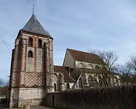 The church in Saint-Lubin-des-Joncherets | |
Location of Saint-Lubin-des-Joncherets | |
 Saint-Lubin-des-Joncherets  Saint-Lubin-des-Joncherets | |
| Coordinates: 48°46′N 1°11′E / 48.77°N 1.19°E | |
| Country | France |
| Region | Centre-Val de Loire |
| Department | Eure-et-Loir |
| Arrondissement | Dreux |
| Canton | Saint-Lubin-des-Joncherets |
| Intercommunality | CA Pays de Dreux |
| Government | |
| • Mayor (2020–2026) | Pascal Artechea[1] |
| Area 1 | 14.46 km2 (5.58 sq mi) |
| Population | 4,062 |
| • Density | 280/km2 (730/sq mi) |
| Time zone | UTC+01:00 (CET) |
| • Summer (DST) | UTC+02:00 (CEST) |
| INSEE/Postal code | 28348 /28350 |
| Elevation | 97–171 m (318–561 ft) (avg. 101 m or 331 ft) |
| 1 French Land Register data, which excludes lakes, ponds, glaciers > 1 km2 (0.386 sq mi or 247 acres) and river estuaries. | |
Saint-Lubin-des-Joncherets (French pronunciation: [sɛ̃ lybɛ̃ de ʒɔ̃ʃʁɛ]) is a commune in the Eure-et-Loir department in northern France. It is located close to the Avre river and the border with the Eure department.
Population
| Year | Pop. | ±% p.a. |
|---|---|---|
| 1968 | 1,882 | — |
| 1975 | 2,304 | +2.93% |
| 1982 | 3,586 | +6.52% |
| 1990 | 4,403 | +2.60% |
| 1999 | 4,355 | −0.12% |
| 2007 | 3,972 | −1.14% |
| 2012 | 4,162 | +0.94% |
| 2017 | 3,995 | −0.82% |
| Source: INSEE[3] | ||
See also
References
- ↑ "Répertoire national des élus: les maires". data.gouv.fr, Plateforme ouverte des données publiques françaises (in French). 9 August 2021.
- ↑ "Populations légales 2021". The National Institute of Statistics and Economic Studies. 28 December 2023.
- ↑ Population en historique depuis 1968, INSEE
Wikimedia Commons has media related to Saint-Lubin-des-Joncherets.
This article is issued from Wikipedia. The text is licensed under Creative Commons - Attribution - Sharealike. Additional terms may apply for the media files.