Saint-Georges-sur-Eure | |
|---|---|
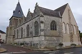 The church in Saint-Georges-sur-Eure | |
.svg.png.webp) Coat of arms | |
Location of Saint-Georges-sur-Eure | |
 Saint-Georges-sur-Eure  Saint-Georges-sur-Eure | |
| Coordinates: 48°25′06″N 1°21′34″E / 48.4183°N 1.3594°E | |
| Country | France |
| Region | Centre-Val de Loire |
| Department | Eure-et-Loir |
| Arrondissement | Chartres |
| Canton | Illiers-Combray |
| Intercommunality | CA Chartres Métropole |
| Government | |
| • Mayor (2020–2026) | Jacky Gaullier[1] |
| Area 1 | 15.43 km2 (5.96 sq mi) |
| Population | 2,759 |
| • Density | 180/km2 (460/sq mi) |
| Time zone | UTC+01:00 (CET) |
| • Summer (DST) | UTC+02:00 (CEST) |
| INSEE/Postal code | 28337 /28190 |
| Elevation | 141–165 m (463–541 ft) (avg. 146 m or 479 ft) |
| 1 French Land Register data, which excludes lakes, ponds, glaciers > 1 km2 (0.386 sq mi or 247 acres) and river estuaries. | |
Saint-Georges-sur-Eure (French pronunciation: [sɛ̃ ʒɔʁʒ syʁ œʁ], literally Saint-Georges on Eure) is a commune in the Eure-et-Loir department in northern France.
Population
| Year | Pop. | ±% p.a. |
|---|---|---|
| 1968 | 1,233 | — |
| 1975 | 1,734 | +4.99% |
| 1982 | 2,039 | +2.34% |
| 1990 | 2,254 | +1.26% |
| 1999 | 2,445 | +0.91% |
| 2007 | 2,514 | +0.35% |
| 2012 | 2,431 | −0.67% |
| 2017 | 2,803 | +2.89% |
| Source: INSEE[3] | ||
See also
References
- ↑ "Répertoire national des élus: les maires". data.gouv.fr, Plateforme ouverte des données publiques françaises (in French). 9 August 2021.
- ↑ "Populations légales 2021". The National Institute of Statistics and Economic Studies. 28 December 2023.
- ↑ Population en historique depuis 1968, INSEE
Wikimedia Commons has media related to Saint-Georges-sur-Eure.
This article is issued from Wikipedia. The text is licensed under Creative Commons - Attribution - Sharealike. Additional terms may apply for the media files.