Marchéville | |
|---|---|
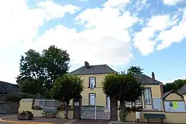 The town hall in Marchéville | |
.svg.png.webp) Coat of arms | |
Location of Marchéville | |
 Marchéville  Marchéville | |
| Coordinates: 48°22′06″N 1°15′11″E / 48.3683°N 1.2531°E | |
| Country | France |
| Region | Centre-Val de Loire |
| Department | Eure-et-Loir |
| Arrondissement | Chartres |
| Canton | Illiers-Combray |
| Government | |
| • Mayor (2020–2026) | Patrick Lage[1] |
| Area 1 | 12.38 km2 (4.78 sq mi) |
| Population | 491 |
| • Density | 40/km2 (100/sq mi) |
| Time zone | UTC+01:00 (CET) |
| • Summer (DST) | UTC+02:00 (CEST) |
| INSEE/Postal code | 28234 /28120 |
| Elevation | 163–207 m (535–679 ft) (avg. 193 m or 633 ft) |
| 1 French Land Register data, which excludes lakes, ponds, glaciers > 1 km2 (0.386 sq mi or 247 acres) and river estuaries. | |
Marchéville (French pronunciation: [maʁʃevil]) is a commune in the Eure-et-Loir department in northern France.
Population
| Year | Pop. | ±% p.a. |
|---|---|---|
| 1968 | 324 | — |
| 1975 | 310 | −0.63% |
| 1982 | 303 | −0.33% |
| 1990 | 379 | +2.84% |
| 1999 | 426 | +1.31% |
| 2009 | 472 | +1.03% |
| 2014 | 518 | +1.88% |
| 2020 | 476 | −1.40% |
| Source: INSEE[3] | ||
See also
References
- ↑ "Répertoire national des élus: les maires" (in French). data.gouv.fr, Plateforme ouverte des données publiques françaises. 13 September 2022.
- ↑ "Populations légales 2021". The National Institute of Statistics and Economic Studies. 28 December 2023.
- ↑ Population en historique depuis 1968, INSEE
Wikimedia Commons has media related to Marchéville.
This article is issued from Wikipedia. The text is licensed under Creative Commons - Attribution - Sharealike. Additional terms may apply for the media files.