Villampuy | |
|---|---|
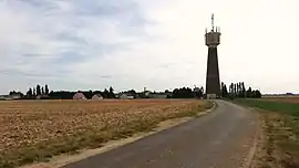 The water tower and surroundings in Villampuy | |
Location of Villampuy | |
 Villampuy  Villampuy | |
| Coordinates: 48°02′08″N 1°30′37″E / 48.0356°N 1.5103°E | |
| Country | France |
| Region | Centre-Val de Loire |
| Department | Eure-et-Loir |
| Arrondissement | Châteaudun |
| Canton | Châteaudun |
| Government | |
| • Mayor (2020–2026) | Vincent Lhopiteau[1] |
| Area 1 | 16.71 km2 (6.45 sq mi) |
| Population | 301 |
| • Density | 18/km2 (47/sq mi) |
| Time zone | UTC+01:00 (CET) |
| • Summer (DST) | UTC+02:00 (CEST) |
| INSEE/Postal code | 28410 /28200 |
| Elevation | 124–135 m (407–443 ft) (avg. 105 m or 344 ft) |
| 1 French Land Register data, which excludes lakes, ponds, glaciers > 1 km2 (0.386 sq mi or 247 acres) and river estuaries. | |
Villampuy (French pronunciation: [vilɑ̃pɥi]) is a commune in the Eure-et-Loir department in northern France.
Population
| Year | Pop. | ±% p.a. |
|---|---|---|
| 1968 | 339 | — |
| 1975 | 301 | −1.68% |
| 1982 | 269 | −1.59% |
| 1990 | 266 | −0.14% |
| 1999 | 228 | −1.70% |
| 2009 | 315 | +3.29% |
| 2014 | 342 | +1.66% |
| 2020 | 302 | −2.05% |
| Source: INSEE[3] | ||
See also
References
- ↑ "Répertoire national des élus: les maires". data.gouv.fr, Plateforme ouverte des données publiques françaises (in French). 2 December 2020.
- ↑ "Populations légales 2021". The National Institute of Statistics and Economic Studies. 28 December 2023.
- ↑ Population en historique depuis 1968, INSEE
Wikimedia Commons has media related to Villampuy.
This article is issued from Wikipedia. The text is licensed under Creative Commons - Attribution - Sharealike. Additional terms may apply for the media files.