Luplanté | |
|---|---|
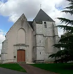 The church in Luplanté | |
Location of Luplanté | |
 Luplanté  Luplanté | |
| Coordinates: 48°18′02″N 1°23′59″E / 48.3006°N 1.3997°E | |
| Country | France |
| Region | Centre-Val de Loire |
| Department | Eure-et-Loir |
| Arrondissement | Chartres |
| Canton | Illiers-Combray |
| Government | |
| • Mayor (2020–2026) | Jacky Huline[1] |
| Area 1 | 16.65 km2 (6.43 sq mi) |
| Population | 386 |
| • Density | 23/km2 (60/sq mi) |
| Time zone | UTC+01:00 (CET) |
| • Summer (DST) | UTC+02:00 (CEST) |
| INSEE/Postal code | 28222 /28360 |
| Elevation | 133–162 m (436–531 ft) (avg. 156 m or 512 ft) |
| 1 French Land Register data, which excludes lakes, ponds, glaciers > 1 km2 (0.386 sq mi or 247 acres) and river estuaries. | |
Luplanté (French pronunciation: [lyplɑ̃te]) is a commune in the Eure-et-Loir department in northern France.
Population
| Year | Pop. | ±% p.a. |
|---|---|---|
| 1968 | 265 | — |
| 1975 | 241 | −1.35% |
| 1982 | 267 | +1.47% |
| 1990 | 260 | −0.33% |
| 1999 | 317 | +2.23% |
| 2009 | 398 | +2.30% |
| 2014 | 391 | −0.35% |
| 2020 | 385 | −0.26% |
| Source: INSEE[3] | ||
See also
References
- ↑ "Répertoire national des élus: les maires". data.gouv.fr, Plateforme ouverte des données publiques françaises (in French). 2 December 2020.
- ↑ "Populations légales 2021". The National Institute of Statistics and Economic Studies. 28 December 2023.
- ↑ Population en historique depuis 1968, INSEE
Wikimedia Commons has media related to Luplanté.
This article is issued from Wikipedia. The text is licensed under Creative Commons - Attribution - Sharealike. Additional terms may apply for the media files.