La Verpillière | |
|---|---|
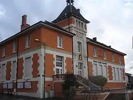 Town hall | |
 Coat of arms | |
Location of La Verpillière | |
 La Verpillière  La Verpillière | |
| Coordinates: 45°38′16″N 5°08′37″E / 45.6378°N 5.1436°E | |
| Country | France |
| Region | Auvergne-Rhône-Alpes |
| Department | Isère |
| Arrondissement | La Tour-du-Pin |
| Canton | La Verpillière |
| Intercommunality | CA Porte de l'Isère |
| Government | |
| • Mayor (2020–2026) | Patrick Margier[1] |
| Area 1 | 6.64 km2 (2.56 sq mi) |
| Population | 7,500 |
| • Density | 1,100/km2 (2,900/sq mi) |
| Time zone | UTC+01:00 (CET) |
| • Summer (DST) | UTC+02:00 (CEST) |
| INSEE/Postal code | 38537 /38290 |
| Elevation | 205–305 m (673–1,001 ft) |
| 1 French Land Register data, which excludes lakes, ponds, glaciers > 1 km2 (0.386 sq mi or 247 acres) and river estuaries. | |
La Verpillière (French pronunciation: [la vɛʁpijɛʁ]) is a commune in the Isère department in southeastern France.[3]
La Verpillière railway station on the line between Lyon and Grenoble is located to the south-east of the town center.
Geography
The Bourbre flows northwest through the northern part of the commune.
Population
|
| ||||||||||||||||||||||||||||||||||||||||||||||||||||||||||||||||||||||||||||||||||||||||||||||||||||||||||||||||||
| Source: EHESS[4] and INSEE (1968-2017)[5] | |||||||||||||||||||||||||||||||||||||||||||||||||||||||||||||||||||||||||||||||||||||||||||||||||||||||||||||||||||
See also
References
- ↑ "Répertoire national des élus: les maires" (in French). data.gouv.fr, Plateforme ouverte des données publiques françaises. 13 September 2022.
- ↑ "Populations légales 2021". The National Institute of Statistics and Economic Studies. 28 December 2023.
- ↑ INSEE commune file
- ↑ Des villages de Cassini aux communes d'aujourd'hui: Commune data sheet La Verpillière, EHESS (in French).
- ↑ Population en historique depuis 1968, INSEE
Wikimedia Commons has media related to La Verpillière.
This article is issued from Wikipedia. The text is licensed under Creative Commons - Attribution - Sharealike. Additional terms may apply for the media files.