Saint-Clair-sur-Galaure | |
|---|---|
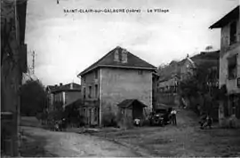 Saint-Clair-sur-Gallure in 1912 | |
Location of Saint-Clair-sur-Galaure | |
 Saint-Clair-sur-Galaure  Saint-Clair-sur-Galaure | |
| Coordinates: 45°15′39″N 5°08′43″E / 45.2608°N 5.1453°E | |
| Country | France |
| Region | Auvergne-Rhône-Alpes |
| Department | Isère |
| Arrondissement | Vienne |
| Canton | Bièvre |
| Government | |
| • Mayor (2020–2026) | Kirsten Clerino[1] |
| Area 1 | 15.3 km2 (5.9 sq mi) |
| Population | 261 |
| • Density | 17/km2 (44/sq mi) |
| Time zone | UTC+01:00 (CET) |
| • Summer (DST) | UTC+02:00 (CEST) |
| INSEE/Postal code | 38379 /38940 |
| Elevation | 388–540 m (1,273–1,772 ft) (avg. 412 m or 1,352 ft) |
| 1 French Land Register data, which excludes lakes, ponds, glaciers > 1 km2 (0.386 sq mi or 247 acres) and river estuaries. | |
Saint-Clair-sur-Galaure (French pronunciation: [sɛ̃ klɛʁ syʁ ɡalɔʁ], literally Saint-Clair on Galaure) is a commune in the Isère department in southeastern France.[3]
Geography
The Galaure flows west through the southern part of the commune.
Population
| Year | Pop. | ±% p.a. |
|---|---|---|
| 1968 | 230 | — |
| 1975 | 203 | −1.77% |
| 1982 | 228 | +1.67% |
| 1990 | 249 | +1.11% |
| 1999 | 248 | −0.04% |
| 2009 | 266 | +0.70% |
| 2014 | 272 | +0.45% |
| 2020 | 263 | −0.56% |
| Source: INSEE[4] | ||
See also
References
Wikimedia Commons has media related to Saint-Clair-sur-Galaure.
- ↑ "Répertoire national des élus: les maires" (in French). data.gouv.fr, Plateforme ouverte des données publiques françaises. 13 September 2022.
- ↑ "Populations légales 2021". The National Institute of Statistics and Economic Studies. 28 December 2023.
- ↑ INSEE commune file
- ↑ Population en historique depuis 1968, INSEE
This article is issued from Wikipedia. The text is licensed under Creative Commons - Attribution - Sharealike. Additional terms may apply for the media files.