Saint-André-en-Royans | |
|---|---|
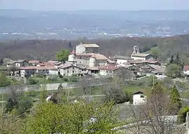 A general view of Saint-André-en-Royans | |
 Coat of arms | |
Location of Saint-André-en-Royans | |
 Saint-André-en-Royans  Saint-André-en-Royans | |
| Coordinates: 45°05′12″N 5°20′22″E / 45.0867°N 5.3394°E | |
| Country | France |
| Region | Auvergne-Rhône-Alpes |
| Department | Isère |
| Arrondissement | Grenoble |
| Canton | Le Sud Grésivaudan |
| Government | |
| • Mayor (2020–2026) | Frédéric de Azevedo[1] |
| Area 1 | 10.42 km2 (4.02 sq mi) |
| Population | 331 |
| • Density | 32/km2 (82/sq mi) |
| Time zone | UTC+01:00 (CET) |
| • Summer (DST) | UTC+02:00 (CEST) |
| INSEE/Postal code | 38356 /38680 |
| Elevation | 224–1,007 m (735–3,304 ft) (avg. 320 m or 1,050 ft) |
| 1 French Land Register data, which excludes lakes, ponds, glaciers > 1 km2 (0.386 sq mi or 247 acres) and river estuaries. | |
Saint-André-en-Royans (French pronunciation: [sɛ̃t‿ɑ̃dʁe ɑ̃ ʁwajɑ̃]; Occitan: Sent Andrieu de Roians) is a commune in the Isère department in southeastern France.[3]
Population
| Year | Pop. | ±% p.a. |
|---|---|---|
| 1968 | 278 | — |
| 1975 | 239 | −2.14% |
| 1982 | 251 | +0.70% |
| 1990 | 273 | +1.06% |
| 1999 | 297 | +0.94% |
| 2009 | 326 | +0.94% |
| 2014 | 323 | −0.18% |
| 2020 | 321 | −0.10% |
| Source: INSEE[4] | ||
See also
References
- ↑ "Répertoire national des élus: les maires". data.gouv.fr, Plateforme ouverte des données publiques françaises (in French). 2 December 2020.
- ↑ "Populations légales 2021". The National Institute of Statistics and Economic Studies. 28 December 2023.
- ↑ INSEE commune file
- ↑ Population en historique depuis 1968, INSEE
Wikimedia Commons has media related to Saint-André-en-Royans.
This article is issued from Wikipedia. The text is licensed under Creative Commons - Attribution - Sharealike. Additional terms may apply for the media files.