Porte-des-Bonnevaux | |
|---|---|
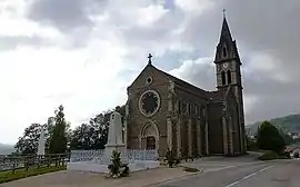 The church of Semons | |
Location of Porte-des-Bonnevaux | |
 Porte-des-Bonnevaux  Porte-des-Bonnevaux | |
| Coordinates: 45°25′58″N 5°11′44″E / 45.4328°N 5.1956°E | |
| Country | France |
| Region | Auvergne-Rhône-Alpes |
| Department | Isère |
| Arrondissement | Vienne |
| Canton | Bièvre |
| Intercommunality | Bièvre Isère |
| Government | |
| • Mayor (2020–2026) | Alain Meunier[1] |
| Area 1 | 43.88 km2 (16.94 sq mi) |
| Population | 2,071 |
| • Density | 47/km2 (120/sq mi) |
| Time zone | UTC+01:00 (CET) |
| • Summer (DST) | UTC+02:00 (CEST) |
| INSEE/Postal code | 38479 /38260 |
| Elevation | 375–609 m (1,230–1,998 ft) |
| 1 French Land Register data, which excludes lakes, ponds, glaciers > 1 km2 (0.386 sq mi or 247 acres) and river estuaries. | |
Porte-des-Bonnevaux (French pronunciation: [pɔʁt de bɔnvo]) is a commune in the Isère department in southeastern France.[3] It was established on 1 January 2019 by merger of the former communes of Semons (the seat), Arzay, Commelle and Nantoin.[4]
Population
| Year | Pop. | ±% p.a. |
|---|---|---|
| 1968 | 979 | — |
| 1975 | 1,013 | +0.49% |
| 1982 | 1,214 | +2.62% |
| 1990 | 1,330 | +1.15% |
| 1999 | 1,379 | +0.40% |
| 2007 | 1,684 | +2.53% |
| 2012 | 1,872 | +2.14% |
| 2017 | 2,015 | +1.48% |
| Source: INSEE[5] | ||
See also
References
- ↑ "Répertoire national des élus: les maires" (in French). data.gouv.fr, Plateforme ouverte des données publiques françaises. 13 September 2022.
- ↑ "Populations légales 2021". The National Institute of Statistics and Economic Studies. 28 December 2023.
- ↑ INSEE commune file
- ↑ Arrêté préfectoral 12 November 2018 (in French)
- ↑ Population en historique depuis 1968, INSEE
Wikimedia Commons has media related to Porte-des-Bonnevaux.
This article is issued from Wikipedia. The text is licensed under Creative Commons - Attribution - Sharealike. Additional terms may apply for the media files.