Saint-Bueil | |
|---|---|
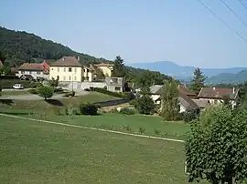 A general view of Saint-Bueil | |
Location of Saint-Bueil | |
 Saint-Bueil  Saint-Bueil | |
| Coordinates: 45°28′38″N 5°40′59″E / 45.4772°N 5.6831°E | |
| Country | France |
| Region | Auvergne-Rhône-Alpes |
| Department | Isère |
| Arrondissement | La Tour-du-Pin |
| Canton | Chartreuse-Guiers |
| Intercommunality | CA Pays Voironnais |
| Government | |
| • Mayor (2020–2026) | Jean-Pierre Loconte[1] |
| Area 1 | 3.81 km2 (1.47 sq mi) |
| Population | 709 |
| • Density | 190/km2 (480/sq mi) |
| Time zone | UTC+01:00 (CET) |
| • Summer (DST) | UTC+02:00 (CEST) |
| INSEE/Postal code | 38372 /38620 |
| Elevation | 293–570 m (961–1,870 ft) (avg. 320 m or 1,050 ft) |
| 1 French Land Register data, which excludes lakes, ponds, glaciers > 1 km2 (0.386 sq mi or 247 acres) and river estuaries. | |
Saint-Bueil (French pronunciation: [sɛ̃ bɥɛj]; Arpitan: Sant-Buely) is a commune in the Isère department in southeastern France.[3]
Population
| Year | Pop. | ±% p.a. |
|---|---|---|
| 1968 | 534 | — |
| 1975 | 516 | −0.49% |
| 1982 | 585 | +1.81% |
| 1990 | 559 | −0.57% |
| 1999 | 628 | +1.30% |
| 2009 | 701 | +1.11% |
| 2014 | 704 | +0.09% |
| 2020 | 718 | +0.33% |
| Source: INSEE[4] | ||
See also
References
- ↑ "Répertoire national des élus: les maires". data.gouv.fr, Plateforme ouverte des données publiques françaises (in French). 2 December 2020.
- ↑ "Populations légales 2021". The National Institute of Statistics and Economic Studies. 28 December 2023.
- ↑ INSEE commune file
- ↑ Population en historique depuis 1968, INSEE
Wikimedia Commons has media related to Saint-Bueil.
This article is issued from Wikipedia. The text is licensed under Creative Commons - Attribution - Sharealike. Additional terms may apply for the media files.