Saint-Sauveur | |
|---|---|
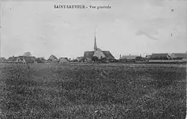 Saint-Sauveur in 1921 | |
Location of Saint-Sauveur | |
 Saint-Sauveur  Saint-Sauveur | |
| Coordinates: 45°09′12″N 5°20′32″E / 45.1533°N 5.3422°E | |
| Country | France |
| Region | Auvergne-Rhône-Alpes |
| Department | Isère |
| Arrondissement | Grenoble |
| Canton | Le Sud Grésivaudan |
| Intercommunality | Saint-Marcellin Vercors Isère |
| Government | |
| • Mayor (2020–2026) | Marie-Jeanne Dabadie[1] |
| Area 1 | 9.42 km2 (3.64 sq mi) |
| Population | 2,115 |
| • Density | 220/km2 (580/sq mi) |
| Time zone | UTC+01:00 (CET) |
| • Summer (DST) | UTC+02:00 (CEST) |
| INSEE/Postal code | 38454 /38160 |
| Elevation | 160–301 m (525–988 ft) (avg. 276 m or 906 ft) |
| 1 French Land Register data, which excludes lakes, ponds, glaciers > 1 km2 (0.386 sq mi or 247 acres) and river estuaries. | |
Saint-Sauveur (French pronunciation: [sɛ̃ sovœʁ] ⓘ) is a commune in the Isère department in southeastern France.[3]
Population
|
| ||||||||||||||||||||||||||||||||||||||||||||||||||||||
| Source: EHESS[4] and INSEE (1968-2017)[5] | |||||||||||||||||||||||||||||||||||||||||||||||||||||||
Transport
There is a train station in the nearby town of Saint-Marcellin
See also
References
Wikimedia Commons has media related to Saint-Sauveur (Isère).
- ↑ "Répertoire national des élus: les maires" (in French). data.gouv.fr, Plateforme ouverte des données publiques françaises. 13 September 2022.
- ↑ "Populations légales 2021". The National Institute of Statistics and Economic Studies. 28 December 2023.
- ↑ INSEE commune file
- ↑ Des villages de Cassini aux communes d'aujourd'hui: Commune data sheet Saint-Sauveur, EHESS (in French).
- ↑ Population en historique depuis 1968, INSEE
This article is issued from Wikipedia. The text is licensed under Creative Commons - Attribution - Sharealike. Additional terms may apply for the media files.