Laveraët | |
|---|---|
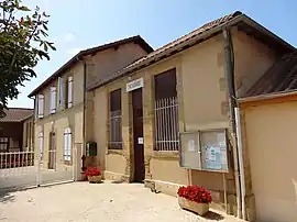 The town hall in Laveraët | |
Location of Laveraët | |
 Laveraët  Laveraët | |
| Coordinates: 43°31′53″N 0°12′53″E / 43.5314°N 0.2147°E | |
| Country | France |
| Region | Occitania |
| Department | Gers |
| Arrondissement | Mirande |
| Canton | Pardiac-Rivière-Basse |
| Intercommunality | Bastides et vallons du Gers |
| Government | |
| • Mayor (2020–2026) | Jean-Claude Lascombes[1] |
| Area 1 | 11.86 km2 (4.58 sq mi) |
| Population | 104 |
| • Density | 8.8/km2 (23/sq mi) |
| Time zone | UTC+01:00 (CET) |
| • Summer (DST) | UTC+02:00 (CEST) |
| INSEE/Postal code | 32205 /32230 |
| Elevation | 154–280 m (505–919 ft) (avg. 200 m or 660 ft) |
| 1 French Land Register data, which excludes lakes, ponds, glaciers > 1 km2 (0.386 sq mi or 247 acres) and river estuaries. | |
Laveraët is a commune in the Gers department in southwestern France.
Geography
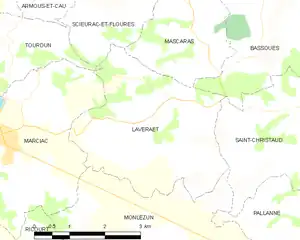
Laveraët and its surrounding communes
Population
| Year | Pop. | ±% |
|---|---|---|
| 1962 | 178 | — |
| 1968 | 173 | −2.8% |
| 1975 | 143 | −17.3% |
| 1982 | 131 | −8.4% |
| 1990 | 134 | +2.3% |
| 1999 | 104 | −22.4% |
| 2008 | 120 | +15.4% |
See also
References
- ↑ "Répertoire national des élus: les maires". data.gouv.fr, Plateforme ouverte des données publiques françaises (in French). 2 December 2020.
- ↑ "Populations légales 2021". The National Institute of Statistics and Economic Studies. 28 December 2023.
Wikimedia Commons has media related to Laveraët.
This article is issued from Wikipedia. The text is licensed under Creative Commons - Attribution - Sharealike. Additional terms may apply for the media files.