Ligardes | |
|---|---|
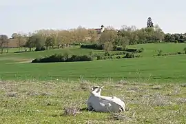 Cattle and a general view of Ligardes | |
Location of Ligardes | |
 Ligardes  Ligardes | |
| Coordinates: 44°02′29″N 0°29′00″E / 44.0414°N 0.4833°E | |
| Country | France |
| Region | Occitania |
| Department | Gers |
| Arrondissement | Condom |
| Canton | Lectoure-Lomagne |
| Intercommunality | Ténarèze |
| Government | |
| • Mayor (2020–2026) | Pierre Dulong[1] |
| Area 1 | 11.3 km2 (4.4 sq mi) |
| Population | 209 |
| • Density | 18/km2 (48/sq mi) |
| Demonym(s) | Ligardais, Ligardaises |
| Time zone | UTC+01:00 (CET) |
| • Summer (DST) | UTC+02:00 (CEST) |
| INSEE/Postal code | 32212 /32480 |
| Elevation | 77–182 m (253–597 ft) (avg. 200 m or 660 ft) |
| 1 French Land Register data, which excludes lakes, ponds, glaciers > 1 km2 (0.386 sq mi or 247 acres) and river estuaries. | |
Ligardes (French pronunciation: [liɡaʁd]; Occitan: Ligardas) is a commune in the Gers department in southwestern France.
Geography

Ligardes and its surrounding communes
Population
| Year | Pop. | ±% p.a. |
|---|---|---|
| 1968 | 280 | — |
| 1975 | 247 | −1.78% |
| 1982 | 261 | +0.79% |
| 1990 | 269 | +0.38% |
| 1999 | 250 | −0.81% |
| 2007 | 237 | −0.67% |
| 2012 | 218 | −1.66% |
| 2017 | 217 | −0.09% |
| Source: INSEE[3] | ||
See also
References
- ↑ "Répertoire national des élus: les maires" (in French). data.gouv.fr, Plateforme ouverte des données publiques françaises. 13 September 2022.
- ↑ "Populations légales 2021". The National Institute of Statistics and Economic Studies. 28 December 2023.
- ↑ Population en historique depuis 1968, INSEE
Wikimedia Commons has media related to Ligardes.
This article is issued from Wikipedia. The text is licensed under Creative Commons - Attribution - Sharealike. Additional terms may apply for the media files.