Samatan | |
|---|---|
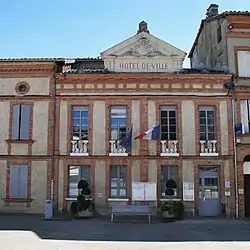 Samatan Town Hall | |
.svg.png.webp) Coat of arms | |
Location of Samatan | |
 Samatan  Samatan | |
| Coordinates: 43°29′37″N 0°55′54″E / 43.4936°N 0.9317°E | |
| Country | France |
| Region | Occitania |
| Department | Gers |
| Arrondissement | Auch |
| Canton | Val de Save |
| Intercommunality | Savès |
| Government | |
| • Mayor (2020–2026) | Hervé Lefebvre[1] |
| Area 1 | 33.53 km2 (12.95 sq mi) |
| Population | 2,429 |
| • Density | 72/km2 (190/sq mi) |
| Time zone | UTC+01:00 (CET) |
| • Summer (DST) | UTC+02:00 (CEST) |
| INSEE/Postal code | 32410 /32130 |
| Elevation | 155–252 m (509–827 ft) (avg. 165 m or 541 ft) |
| 1 French Land Register data, which excludes lakes, ponds, glaciers > 1 km2 (0.386 sq mi or 247 acres) and river estuaries. | |
Samatan (French pronunciation: [samatɑ̃]) is a commune in the Gers department in the Occitania region in Southwestern France.
Geography
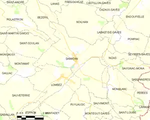
Samatan and its surrounding communes
Demographics
| Year | Pop. | ±% p.a. |
|---|---|---|
| 1968 | 1,934 | — |
| 1975 | 1,840 | −0.71% |
| 1982 | 1,831 | −0.07% |
| 1990 | 1,716 | −0.81% |
| 1999 | 1,832 | +0.73% |
| 2009 | 2,297 | +2.29% |
| 2014 | 2,377 | +0.69% |
| 2020 | 2,380 | +0.02% |
| Source: INSEE[3] | ||
See also
References
- ↑ "Répertoire national des élus: les maires" (in French). data.gouv.fr, Plateforme ouverte des données publiques françaises. 13 September 2022.
- ↑ "Populations légales 2021". The National Institute of Statistics and Economic Studies. 28 December 2023.
- ↑ Population en historique depuis 1968, INSEE
Wikimedia Commons has media related to Samatan (Gers).
This article is issued from Wikipedia. The text is licensed under Creative Commons - Attribution - Sharealike. Additional terms may apply for the media files.