Épécamps | |
|---|---|
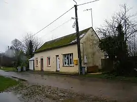 Town hall. | |
Location of Épécamps | |
 Épécamps  Épécamps | |
| Coordinates: 50°06′48″N 2°09′21″E / 50.1133°N 2.1558°E | |
| Country | France |
| Region | Hauts-de-France |
| Department | Somme |
| Arrondissement | Amiens |
| Canton | Doullens |
| Intercommunality | Territoire Nord Picardie |
| Government | |
| • Mayor (2023–2026) | Dimitri Cahon[1] |
| Area 1 | 1.6 km2 (0.6 sq mi) |
| Population | 6 |
| • Density | 3.8/km2 (9.7/sq mi) |
| Time zone | UTC+01:00 (CET) |
| • Summer (DST) | UTC+02:00 (CEST) |
| INSEE/Postal code | 80270 /80370 |
| Elevation | 75–146 m (246–479 ft) (avg. 136 m or 446 ft) |
| 1 French Land Register data, which excludes lakes, ponds, glaciers > 1 km2 (0.386 sq mi or 247 acres) and river estuaries. | |
Épécamps (French pronunciation: [epekɑ̃]) is a commune in the Somme department in Hauts-de-France in northern France.
Geography
The least populous commune in the department, Épécamps is situated on the D118 road, some 28 km (17 mi) east of Abbeville.
Population
| Year | Pop. | ±% p.a. |
|---|---|---|
| 1968 | 10 | — |
| 1975 | 13 | +3.82% |
| 1982 | 12 | −1.14% |
| 1990 | 12 | +0.00% |
| 1999 | 11 | −0.96% |
| 2007 | 8 | −3.90% |
| 2012 | 5 | −8.97% |
| 2017 | 5 | +0.00% |
| Source: INSEE[3] | ||
.JPG.webp) The church.
The church.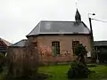 North side.
.jpg.webp) East side.
East side.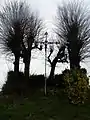 Calvary.
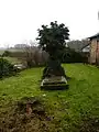 Cemetery.
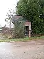 Water tower.
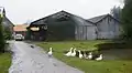 Body of water.
See also
References
- ↑ "Répertoire national des élus: les maires" (in French). data.gouv.fr, Plateforme ouverte des données publiques françaises. 6 June 2023.
- ↑ "Populations légales 2021". The National Institute of Statistics and Economic Studies. 28 December 2023.
- ↑ Population en historique depuis 1968, INSEE
Wikimedia Commons has media related to Épécamps.
This article is issued from Wikipedia. The text is licensed under Creative Commons - Attribution - Sharealike. Additional terms may apply for the media files.