Lafresguimont-Saint-Martin | |
|---|---|
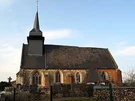 The church in Lafresnoye | |
Location of Lafresguimont-Saint-Martin | |
 Lafresguimont-Saint-Martin  Lafresguimont-Saint-Martin | |
| Coordinates: 49°48′58″N 1°48′35″E / 49.8161°N 1.8097°E | |
| Country | France |
| Region | Hauts-de-France |
| Department | Somme |
| Arrondissement | Amiens |
| Canton | Poix-de-Picardie |
| Intercommunality | CC Somme Sud-Ouest |
| Government | |
| • Mayor (2020–2026) | Jannick Lefeuvre[1] |
| Area 1 | 26.54 km2 (10.25 sq mi) |
| Population | 555 |
| • Density | 21/km2 (54/sq mi) |
| Time zone | UTC+01:00 (CET) |
| • Summer (DST) | UTC+02:00 (CEST) |
| INSEE/Postal code | 80456 /80430 |
| Elevation | 100–210 m (330–690 ft) (avg. 185 m or 607 ft) |
| 1 French Land Register data, which excludes lakes, ponds, glaciers > 1 km2 (0.386 sq mi or 247 acres) and river estuaries. | |
Lafresguimont-Saint-Martin is a commune in the Somme department in Hauts-de-France in northern France.
Geography
The commune is situated at the junction of the D92 and the D178 roads, 40 kilometres (25 mi) southwest of Amiens.
History
The commune was created by the amalgamation of four separate communes in 1972 : Montmarquet, Lafresnoye, Guibermesnil and Laboissière-Saint-Martin. The present name is a combination of the older names.
Population
| Year | Pop. | ±% p.a. |
|---|---|---|
| 1968 | 604 | — |
| 1975 | 570 | −0.82% |
| 1982 | 501 | −1.83% |
| 1990 | 470 | −0.80% |
| 1999 | 445 | −0.61% |
| 2007 | 508 | +1.67% |
| 2012 | 503 | −0.20% |
| 2017 | 550 | +1.80% |
| Source: INSEE[3] | ||
See also
References
- ↑ "Répertoire national des élus: les maires". data.gouv.fr, Plateforme ouverte des données publiques françaises (in French). 2 December 2020.
- ↑ "Populations légales 2021". The National Institute of Statistics and Economic Studies. 28 December 2023.
- ↑ Population en historique depuis 1968, INSEE
Wikimedia Commons has media related to Lafresguimont-Saint-Martin.
This article is issued from Wikipedia. The text is licensed under Creative Commons - Attribution - Sharealike. Additional terms may apply for the media files.