Dominois | |
|---|---|
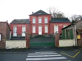 The town hall in Dominois | |
.svg.png.webp) Coat of arms | |
Location of Dominois | |
 Dominois  Dominois | |
| Coordinates: 50°19′56″N 1°51′12″E / 50.3322°N 1.8533°E | |
| Country | France |
| Region | Hauts-de-France |
| Department | Somme |
| Arrondissement | Abbeville |
| Canton | Rue |
| Intercommunality | CC Ponthieu-Marquenterre |
| Government | |
| • Mayor (2020–2026) | Jean-Louis Labry[1] |
| Area 1 | 6.15 km2 (2.37 sq mi) |
| Population | 171 |
| • Density | 28/km2 (72/sq mi) |
| Time zone | UTC+01:00 (CET) |
| • Summer (DST) | UTC+02:00 (CEST) |
| INSEE/Postal code | 80244 /80120 |
| Elevation | 7–74 m (23–243 ft) (avg. 13 m or 43 ft) |
| 1 French Land Register data, which excludes lakes, ponds, glaciers > 1 km2 (0.386 sq mi or 247 acres) and river estuaries. | |
Dominois (French pronunciation: [dɔminwa]; Picard: Domino ) is a commune in the Somme department in Hauts-de-France in northern France.
Geography
Dominois is situated on the D192 road, on the banks of the river Authie, the border with Pas-de-Calais, some 20 miles (32 km) north of Abbeville.
Population
| Year | Pop. | ±% p.a. |
|---|---|---|
| 1968 | 209 | — |
| 1975 | 201 | −0.56% |
| 1982 | 183 | −1.33% |
| 1990 | 169 | −0.99% |
| 1999 | 141 | −1.99% |
| 2007 | 149 | +0.69% |
| 2012 | 203 | +6.38% |
| 2017 | 177 | −2.70% |
| Source: INSEE[3] | ||
See also
References
- ↑ "Répertoire national des élus: les maires" (in French). data.gouv.fr, Plateforme ouverte des données publiques françaises. 13 September 2022.
- ↑ "Populations légales 2021". The National Institute of Statistics and Economic Studies. 28 December 2023.
- ↑ Population en historique depuis 1968, INSEE
Wikimedia Commons has media related to Dominois.
This article is issued from Wikipedia. The text is licensed under Creative Commons - Attribution - Sharealike. Additional terms may apply for the media files.