Curlu | |
|---|---|
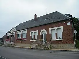 The town hall and school in Curlu | |
Location of Curlu | |
 Curlu  Curlu | |
| Coordinates: 49°57′52″N 2°49′02″E / 49.9644°N 2.8172°E | |
| Country | France |
| Region | Hauts-de-France |
| Department | Somme |
| Arrondissement | Péronne |
| Canton | Albert |
| Intercommunality | Pays du Coquelicot |
| Government | |
| • Mayor (2020–2026) | Patrick Senez[1] |
| Area 1 | 5.89 km2 (2.27 sq mi) |
| Population | 166 |
| • Density | 28/km2 (73/sq mi) |
| Time zone | UTC+01:00 (CET) |
| • Summer (DST) | UTC+02:00 (CEST) |
| INSEE/Postal code | 80231 /80360 |
| Elevation | 42–122 m (138–400 ft) (avg. 55 m or 180 ft) |
| 1 French Land Register data, which excludes lakes, ponds, glaciers > 1 km2 (0.386 sq mi or 247 acres) and river estuaries. | |
Curlu (French pronunciation: [kyʁly]) is a commune in the Somme department in Hauts-de-France in northern France. Curlu is situated on the D146 road, on the banks of the river Somme, some 30 miles (48 km) east of Amiens.
Population
| Year | Pop. | ±% p.a. |
|---|---|---|
| 1968 | 104 | — |
| 1975 | 112 | +1.06% |
| 1982 | 118 | +0.75% |
| 1990 | 117 | −0.11% |
| 1999 | 111 | −0.58% |
| 2007 | 137 | +2.67% |
| 2012 | 138 | +0.15% |
| 2017 | 168 | +4.01% |
| Source: INSEE[3] | ||

The ruins of the village of Curlu during the Battle of the Somme (France).
See also
References
- ↑ "Répertoire national des élus: les maires". data.gouv.fr, Plateforme ouverte des données publiques françaises (in French). 2 December 2020.
- ↑ "Populations légales 2021". The National Institute of Statistics and Economic Studies. 28 December 2023.
- ↑ Population en historique depuis 1968, INSEE
Wikimedia Commons has media related to Curlu.
This article is issued from Wikipedia. The text is licensed under Creative Commons - Attribution - Sharealike. Additional terms may apply for the media files.