Saint-Germain-sur-Bresle | |
|---|---|
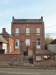 The town hall in Saint-Germain-sur-Bresle | |
Location of Saint-Germain-sur-Bresle | |
 Saint-Germain-sur-Bresle  Saint-Germain-sur-Bresle | |
| Coordinates: 49°49′51″N 1°44′02″E / 49.8308°N 1.7339°E | |
| Country | France |
| Region | Hauts-de-France |
| Department | Somme |
| Arrondissement | Amiens |
| Canton | Poix-de-Picardie |
| Intercommunality | CC Somme Sud-Ouest |
| Government | |
| • Mayor (2020–2026) | Michel Cordier[1] |
| Area 1 | 8.69 km2 (3.36 sq mi) |
| Population | 214 |
| • Density | 25/km2 (64/sq mi) |
| Time zone | UTC+01:00 (CET) |
| • Summer (DST) | UTC+02:00 (CEST) |
| INSEE/Postal code | 80703 /80430 |
| Elevation | 83–208 m (272–682 ft) (avg. 121 m or 397 ft) |
| 1 French Land Register data, which excludes lakes, ponds, glaciers > 1 km2 (0.386 sq mi or 247 acres) and river estuaries. | |
Saint-Germain-sur-Bresle (French pronunciation: [sɛ̃ ʒɛʁmɛ̃ syʁ bʁɛl], literally Saint-Germain on Bresle) is a commune in the Somme department in Hauts-de-France in northern France.
Geography
The commune is situated 16 miles (26 km) south of Abbeville, on the D316 road and by the banks of the river Bresle.
Population
| Year | Pop. | ±% p.a. |
|---|---|---|
| 1968 | 185 | — |
| 1975 | 202 | +1.26% |
| 1982 | 203 | +0.07% |
| 1990 | 167 | −2.41% |
| 1999 | 185 | +1.14% |
| 2007 | 176 | −0.62% |
| 2012 | 210 | +3.60% |
| 2017 | 206 | −0.38% |
| Source: INSEE[3] | ||
See also
References
- ↑ "Répertoire national des élus: les maires". data.gouv.fr, Plateforme ouverte des données publiques françaises (in French). 2 December 2020.
- ↑ "Populations légales 2021". The National Institute of Statistics and Economic Studies. 28 December 2023.
- ↑ Population en historique depuis 1968, INSEE
Wikimedia Commons has media related to Saint-Germain-sur-Bresle.
This article is issued from Wikipedia. The text is licensed under Creative Commons - Attribution - Sharealike. Additional terms may apply for the media files.