Agenvillers | |
|---|---|
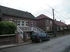 The town hall and school of Agenvillers | |
Location of Agenvillers | |
 Agenvillers  Agenvillers | |
| Coordinates: 50°10′45″N 1°55′13″E / 50.1792°N 1.9203°E | |
| Country | France |
| Region | Hauts-de-France |
| Department | Somme |
| Arrondissement | Abbeville |
| Canton | Abbeville-1 |
| Intercommunality | Ponthieu-Marquenterre |
| Government | |
| • Mayor (2020–2026) | Pascal Farcy[1] |
| Area 1 | 5.98 km2 (2.31 sq mi) |
| Population | 247 |
| • Density | 41/km2 (110/sq mi) |
| Time zone | UTC+01:00 (CET) |
| • Summer (DST) | UTC+02:00 (CEST) |
| INSEE/Postal code | 80006 /80150 |
| Elevation | 58–85 m (190–279 ft) (avg. 84 m or 276 ft) |
| 1 French Land Register data, which excludes lakes, ponds, glaciers > 1 km2 (0.386 sq mi or 247 acres) and river estuaries. | |
Agenvillers (Picard: Ginvilé) is a commune in the Somme department in Hauts-de-France in northern France.
Geography
The communes is a small village about 13 km (8 mi) northeast of Abbeville, on the D82 departmental road.
Population
| Year | Pop. | ±% p.a. |
|---|---|---|
| 1968 | 224 | — |
| 1975 | 206 | −1.19% |
| 1982 | 205 | −0.07% |
| 1990 | 198 | −0.43% |
| 1999 | 181 | −0.99% |
| 2007 | 192 | +0.74% |
| 2012 | 195 | +0.31% |
| 2017 | 228 | +3.18% |
| Source: INSEE[3] | ||
See also
References
- ↑ "Répertoire national des élus: les maires". data.gouv.fr, Plateforme ouverte des données publiques françaises (in French). 9 August 2021.
- ↑ "Populations légales 2021". The National Institute of Statistics and Economic Studies. 28 December 2023.
- ↑ Population en historique depuis 1968, INSEE
External links
Wikimedia Commons has media related to Agenvillers.
(All French language)
This article is issued from Wikipedia. The text is licensed under Creative Commons - Attribution - Sharealike. Additional terms may apply for the media files.