Saint-Quentin-en-Tourmont | |
|---|---|
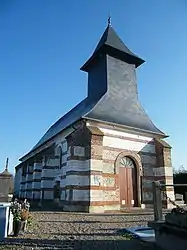 The church | |
Location of Saint-Quentin-en-Tourmont | |
 Saint-Quentin-en-Tourmont  Saint-Quentin-en-Tourmont | |
| Coordinates: 50°17′08″N 1°35′25″E / 50.2856°N 1.5903°E | |
| Country | France |
| Region | Hauts-de-France |
| Department | Somme |
| Arrondissement | Abbeville |
| Canton | Rue |
| Intercommunality | CC Ponthieu-Marquenterre |
| Government | |
| • Mayor (2020–2026) | Francis Gouesbier[1] |
| Area 1 | 32.89 km2 (12.70 sq mi) |
| Population | 288 |
| • Density | 8.8/km2 (23/sq mi) |
| Time zone | UTC+01:00 (CET) |
| • Summer (DST) | UTC+02:00 (CEST) |
| INSEE/Postal code | 80713 /80120 |
| Elevation | 2–36 m (6.6–118.1 ft) (avg. 4 m or 13 ft) |
| 1 French Land Register data, which excludes lakes, ponds, glaciers > 1 km2 (0.386 sq mi or 247 acres) and river estuaries. | |
Saint-Quentin-en-Tourmont (French pronunciation: [sɛ̃ kɑ̃tɛ̃ ɑ̃ tuʁmɔ̃]; Picard: Saint-Quentin-in-Tourmont) is a commune in the Somme department in Hauts-de-France, on the French coast, in northern France.
Geography
The communes is situated some 15 miles (24 km) northwest of Abbeville, on the D204 road, with part of the Marquenterre national park within the commune.
Population
| Year | Pop. | ±% p.a. |
|---|---|---|
| 1968 | 307 | — |
| 1975 | 261 | −2.29% |
| 1982 | 296 | +1.81% |
| 1990 | 309 | +0.54% |
| 1999 | 334 | +0.87% |
| 2007 | 309 | −0.97% |
| 2012 | 309 | +0.00% |
| 2017 | 282 | −1.81% |
| Source: INSEE[3] | ||
See also
References
- ↑ "Répertoire national des élus: les maires". data.gouv.fr, Plateforme ouverte des données publiques françaises (in French). 9 August 2021.
- ↑ "Populations légales 2021". The National Institute of Statistics and Economic Studies. 28 December 2023.
- ↑ Population en historique depuis 1968, INSEE
Wikimedia Commons has media related to Saint-Quentin-en-Tourmont.
This article is issued from Wikipedia. The text is licensed under Creative Commons - Attribution - Sharealike. Additional terms may apply for the media files.