Érôme | |
|---|---|
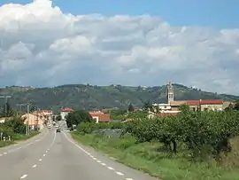 A general view of Érôme | |
Location of Érôme | |
 Érôme  Érôme | |
| Coordinates: 45°07′15″N 4°49′19″E / 45.1208°N 4.8219°E | |
| Country | France |
| Region | Auvergne-Rhône-Alpes |
| Department | Drôme |
| Arrondissement | Valence |
| Canton | Tain-l'Hermitage |
| Intercommunality | CA Arche Agglo |
| Government | |
| • Mayor (2020–2026) | Sandrine Pereira[1] |
| Area 1 | 7.33 km2 (2.83 sq mi) |
| Population | 822 |
| • Density | 110/km2 (290/sq mi) |
| Time zone | UTC+01:00 (CET) |
| • Summer (DST) | UTC+02:00 (CEST) |
| INSEE/Postal code | 26119 /26600 |
| Elevation | 115–377 m (377–1,237 ft) (avg. 134 m or 440 ft) |
| 1 French Land Register data, which excludes lakes, ponds, glaciers > 1 km2 (0.386 sq mi or 247 acres) and river estuaries. | |
Érôme (French pronunciation: [eʁom]; Occitan: Erauma) is a commune in the Drôme department in the Auvergne-Rhône-Alpes region in southeastern France.
Population
| Year | Pop. | ±% p.a. |
|---|---|---|
| 1968 | 624 | — |
| 1975 | 642 | +0.41% |
| 1982 | 626 | −0.36% |
| 1990 | 698 | +1.37% |
| 1999 | 689 | −0.14% |
| 2009 | 835 | +1.94% |
| 2014 | 838 | +0.07% |
| 2020 | 808 | −0.61% |
| Source: INSEE[3] | ||
See also
References
- ↑ "Répertoire national des élus: les maires" (in French). data.gouv.fr, Plateforme ouverte des données publiques françaises. 13 September 2022.
- ↑ "Populations légales 2021". The National Institute of Statistics and Economic Studies. 28 December 2023.
- ↑ Population en historique depuis 1968, INSEE
Wikimedia Commons has media related to Érôme.
This article is issued from Wikipedia. The text is licensed under Creative Commons - Attribution - Sharealike. Additional terms may apply for the media files.