Andancette | |
|---|---|
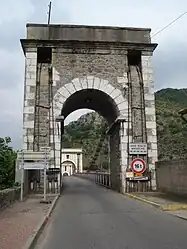 The Marc Seguin suspension bridge over the Rhône | |
.svg.png.webp) Coat of arms | |
Location of Andancette | |
 Andancette  Andancette | |
| Coordinates: 45°14′34″N 4°48′27″E / 45.2427°N 4.8075°E | |
| Country | France |
| Region | Auvergne-Rhône-Alpes |
| Department | Drôme |
| Arrondissement | Valence |
| Canton | Saint-Vallier |
| Intercommunality | Porte de DrômArdèche |
| Government | |
| • Mayor (2020–2026) | Frédéric Chenevier[1] |
| Area 1 | 5.98 km2 (2.31 sq mi) |
| Population | 1,309 |
| • Density | 220/km2 (570/sq mi) |
| Time zone | UTC+01:00 (CET) |
| • Summer (DST) | UTC+02:00 (CEST) |
| INSEE/Postal code | 26009 /26140 |
| Elevation | 129–168 m (423–551 ft) (avg. 138 m or 453 ft) |
| 1 French Land Register data, which excludes lakes, ponds, glaciers > 1 km2 (0.386 sq mi or 247 acres) and river estuaries. | |
Andancette (French pronunciation: [ɑ̃dɑ̃sɛt]) is a commune in the Drôme department in southeastern France.
Geography
Andancette is located:
- 6 km (3.7 mi) from Saint-Rambert-d'Albon
- 6 km (3.7 mi) from Saint-Vallier
- 30 km (19 mi) from Valence
Population
| Year | Pop. | ±% p.a. |
|---|---|---|
| 1968 | 976 | — |
| 1975 | 1,099 | +1.71% |
| 1982 | 1,020 | −1.06% |
| 1990 | 1,157 | +1.59% |
| 1999 | 1,156 | −0.01% |
| 2009 | 1,257 | +0.84% |
| 2014 | 1,331 | +1.15% |
| 2020 | 1,328 | −0.04% |
| Source: INSEE[3] | ||
See also
References
- ↑ "Répertoire national des élus: les maires". data.gouv.fr, Plateforme ouverte des données publiques françaises (in French). 2 December 2020.
- ↑ "Populations légales 2021". The National Institute of Statistics and Economic Studies. 28 December 2023.
- ↑ Population en historique depuis 1968, INSEE
Wikimedia Commons has media related to Andancette.
This article is issued from Wikipedia. The text is licensed under Creative Commons - Attribution - Sharealike. Additional terms may apply for the media files.