La Motte-Fanjas | |
|---|---|
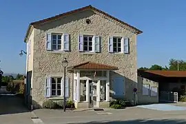 The town hall of La Motte-Fanjas | |
Location of La Motte-Fanjas | |
 La Motte-Fanjas  La Motte-Fanjas | |
| Coordinates: 45°03′06″N 5°16′05″E / 45.0517°N 5.2681°E | |
| Country | France |
| Region | Auvergne-Rhône-Alpes |
| Department | Drôme |
| Arrondissement | Die |
| Canton | Vercors-Monts du Matin |
| Government | |
| • Mayor (2020–2026) | Nicolas Peyretout[1] |
| Area 1 | 4.78 km2 (1.85 sq mi) |
| Population | 194 |
| • Density | 41/km2 (110/sq mi) |
| Time zone | UTC+01:00 (CET) |
| • Summer (DST) | UTC+02:00 (CEST) |
| INSEE/Postal code | 26217 /26190 |
| Elevation | 161–448 m (528–1,470 ft) (avg. 242 m or 794 ft) |
| 1 French Land Register data, which excludes lakes, ponds, glaciers > 1 km2 (0.386 sq mi or 247 acres) and river estuaries. | |
La Motte-Fanjas is a commune in the Drôme department in southeastern France.
Population
| Year | Pop. | ±% p.a. |
|---|---|---|
| 1968 | 118 | — |
| 1975 | 113 | −0.62% |
| 1982 | 121 | +0.98% |
| 1990 | 115 | −0.63% |
| 1999 | 138 | +2.05% |
| 2009 | 168 | +1.99% |
| 2014 | 179 | +1.28% |
| 2020 | 193 | +1.26% |
| Source: INSEE[3] | ||
See also
References
- ↑ "Répertoire national des élus: les maires". data.gouv.fr, Plateforme ouverte des données publiques françaises (in French). 9 August 2021.
- ↑ "Populations légales 2021". The National Institute of Statistics and Economic Studies. 28 December 2023.
- ↑ Population en historique depuis 1968, INSEE
Wikimedia Commons has media related to La Motte-Fanjas.
This article is issued from Wikipedia. The text is licensed under Creative Commons - Attribution - Sharealike. Additional terms may apply for the media files.