Saint-Sauveur-en-Diois | |
|---|---|
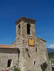 The bell tower and sundial of the church | |
Location of Saint-Sauveur-en-Diois | |
 Saint-Sauveur-en-Diois  Saint-Sauveur-en-Diois | |
| Coordinates: 44°40′52″N 5°09′25″E / 44.681°N 5.157°E | |
| Country | France |
| Region | Auvergne-Rhône-Alpes |
| Department | Drôme |
| Arrondissement | Die |
| Canton | Le Diois |
| Government | |
| • Mayor (2020–2026) | Patricia Puc[1] |
| Area 1 | 6.95 km2 (2.68 sq mi) |
| Population | 52 |
| • Density | 7.5/km2 (19/sq mi) |
| Time zone | UTC+01:00 (CET) |
| • Summer (DST) | UTC+02:00 (CEST) |
| INSEE/Postal code | 26328 /26340 |
| Elevation | 237–1,240 m (778–4,068 ft) (avg. 387 m or 1,270 ft) |
| 1 French Land Register data, which excludes lakes, ponds, glaciers > 1 km2 (0.386 sq mi or 247 acres) and river estuaries. | |
Saint-Sauveur-en-Diois (French pronunciation: [sɛ̃ sovœʁ ɑ̃ diwa]; Vivaro-Alpine: Sant Sauvador de Diés) is a commune in the Drôme department in southeastern France.
Population
| Year | Pop. | ±% p.a. |
|---|---|---|
| 1968 | 58 | — |
| 1975 | 40 | −5.17% |
| 1982 | 41 | +0.35% |
| 1990 | 35 | −1.96% |
| 1999 | 52 | +4.50% |
| 2009 | 64 | +2.10% |
| 2014 | 56 | −2.64% |
| 2020 | 53 | −0.91% |
| Source: INSEE[3] | ||
See also
References
- ↑ "Répertoire national des élus: les maires". data.gouv.fr, Plateforme ouverte des données publiques françaises (in French). 9 August 2021.
- ↑ "Populations légales 2021". The National Institute of Statistics and Economic Studies. 28 December 2023.
- ↑ Population en historique depuis 1968, INSEE
Wikimedia Commons has media related to Saint-Sauveur-en-Diois.
This article is issued from Wikipedia. The text is licensed under Creative Commons - Attribution - Sharealike. Additional terms may apply for the media files.