Francillon-sur-Roubion | |
|---|---|
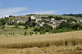 A general view of Francillon-sur-Roubion | |
Location of Francillon-sur-Roubion | |
 Francillon-sur-Roubion  Francillon-sur-Roubion | |
| Coordinates: 44°37′29″N 5°05′14″E / 44.6247°N 5.0872°E | |
| Country | France |
| Region | Auvergne-Rhône-Alpes |
| Department | Drôme |
| Arrondissement | Die |
| Canton | Dieulefit |
| Intercommunality | Val de Drôme en Biovallée |
| Government | |
| • Mayor (2020–2026) | Jean-Michel Gaudet[1] |
| Area 1 | 10.8 km2 (4.2 sq mi) |
| Population | 188 |
| • Density | 17/km2 (45/sq mi) |
| Time zone | UTC+01:00 (CET) |
| • Summer (DST) | UTC+02:00 (CEST) |
| INSEE/Postal code | 26137 /26400 |
| Elevation | 287–651 m (942–2,136 ft) (avg. 462 m or 1,516 ft) |
| 1 French Land Register data, which excludes lakes, ponds, glaciers > 1 km2 (0.386 sq mi or 247 acres) and river estuaries. | |
Francillon-sur-Roubion (French pronunciation: [fʁɑ̃sijɔ̃ syʁ ʁubjɔ̃]; Occitan: Francilhon) is a commune in the Drôme department in the Auvergne-Rhône-Alpes region in southeastern France.
Population
| Year | Pop. | ±% p.a. |
|---|---|---|
| 1968 | 119 | — |
| 1975 | 122 | +0.36% |
| 1982 | 133 | +1.24% |
| 1990 | 124 | −0.87% |
| 1999 | 140 | +1.36% |
| 2009 | 176 | +2.31% |
| 2014 | 184 | +0.89% |
| 2020 | 192 | +0.71% |
| Source: INSEE[3] | ||
See also
References
- ↑ "Répertoire national des élus: les maires" (in French). data.gouv.fr, Plateforme ouverte des données publiques françaises. 13 September 2022.
- ↑ "Populations légales 2021". The National Institute of Statistics and Economic Studies. 28 December 2023.
- ↑ Population en historique depuis 1968, INSEE
Wikimedia Commons has media related to Francillon-sur-Roubion.
This article is issued from Wikipedia. The text is licensed under Creative Commons - Attribution - Sharealike. Additional terms may apply for the media files.